

By Joseph D’Aleo
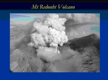
In April 2009, we talked about Mt Redoubt’s eruption (and later Russia’s Sarychev) and the effect it might have on high latitude blocking and cooler summer and winter.
Climatologists may disagree on how much the recent global warming is natural or manmade but there is general agreement that volcanism constitutes a wildcard in climate, producing significant global scale cooling for at least a few years following a major eruption. However, there are some interesting seasonal and regional variations of the effects.
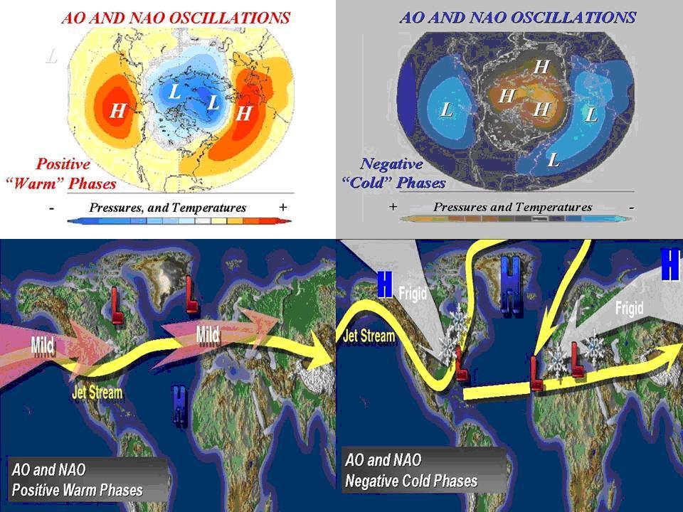
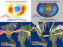
Oman et al (2005) and others have shown that though major volcanic eruptions seem to have their greatest cooling effect in the summer months, the location of the volcano determines whether the winters are colder or warmer over large parts of North America and Eurasia. According to their modeling, tropical region volcanoes like El Chichon and Pinatubo actually produce a warming in winter due to a tendency for a more positive North Atlantic Oscillation (NAO) and Arctic Oscillation (AO). In the positive phase of these large scale pressure oscillations, low pressure and cold air is trapped in high latitudes and the resulting more westerly jet stream winds drives milder maritime air into the continents.
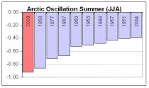
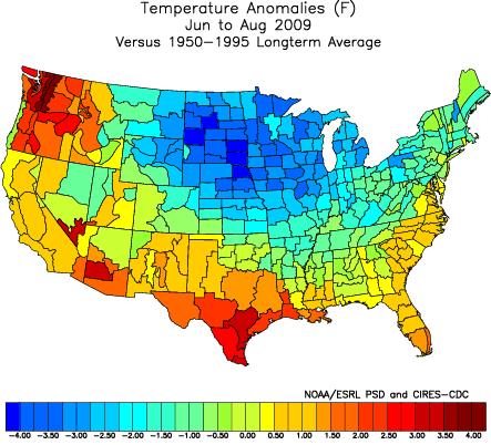
The summer of 2009 had the most negative AO since 1950. Which explains the cold summer (especially July) (below, enlarged here).
.
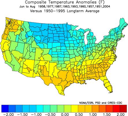
Summers with a very negative AO above have a cold anomaly centered in the nation’s midsection (below, enlarged here).
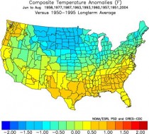
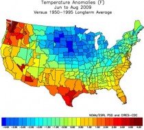
Last summer saw that pattern (below, enlarged here).
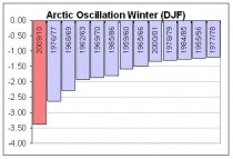
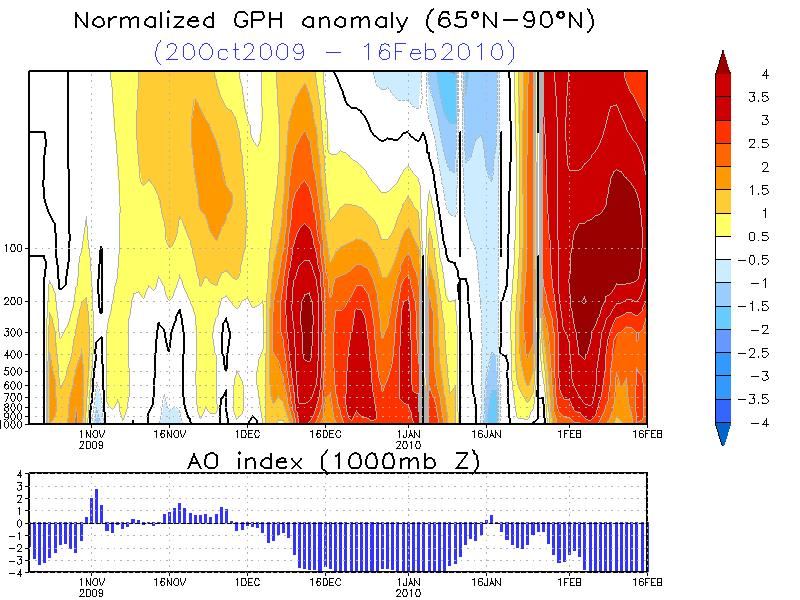
The AO has stayed very negative this winter. In fact again the most negative of any winter since 2009/10. It has averaged almost 3.5 standard deviations negative. In both December and February, it has reached more then 5 STD (below, enlarged here).
Negative AO/NAO winters are cold and often snowy in the US and Europe (below, enlarged here).
The strongest blocking years have a warm polar stratosphere and mid troposphere. Certainly that has been the case this year. (below, enlarged here).
The most negative years when composited show widespread cold (below, enlarged here).
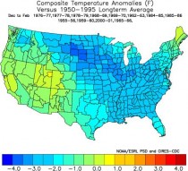
This winter has been cold especially in the central and southeast through February 16th (below, enlarged here).
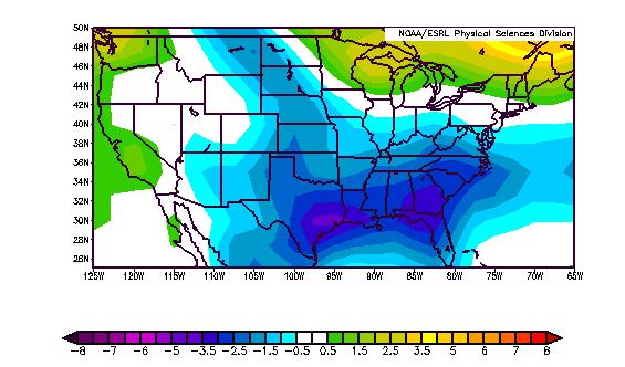
And certainly also all across Asia into Europe (below, enlarged here).
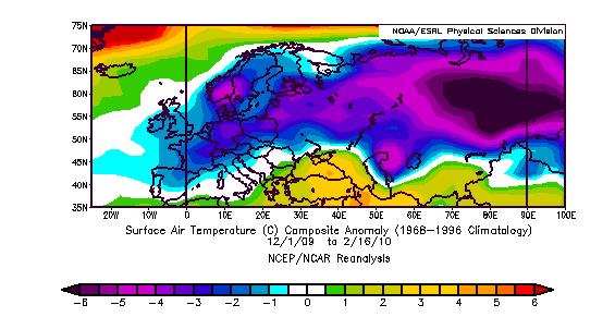
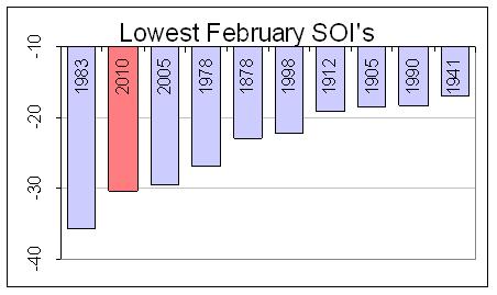
It also has been an El Nino year, the case in about half the top ten most negative AO years. The Southern Oscillation Index has dropped on a daily basis to an amazing 8 STD negative in early February. For the first 19 days, it has been most negative February since 1870.
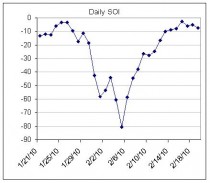
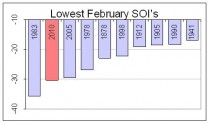
(Most negative SOI Februarys enlarged here).
The pattern show a good match this year to El Nino negative AO years (bottom right below, enlarged here).
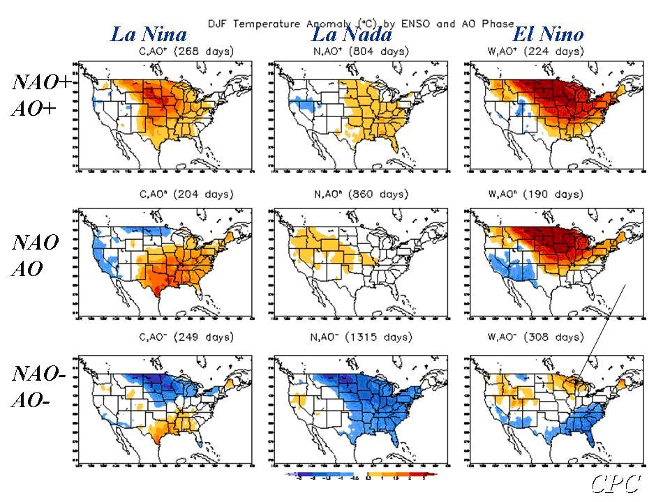

See more here. Listen to this PODCAST (episodes on left #21) on November 10 on WeatherJazz which I did with fellow meteorologist Andre Bernier on long range forecasting and the upcoming winter where we predicted east coast storms and a negative AO/NAO based on natural factors.