


By Joseph D’Aleo
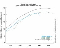
This is the latest NSIDC Northern Hemisphere Arctic sea ice extent. See the sudden dip below the 2007 February level.
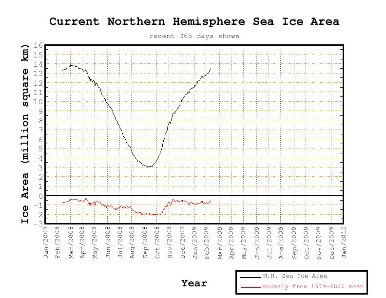
But wait a minute. Take a look at the Northern Hemisphere Ice Extent according to the Cryosphere Today which shows a blip up not down
...and an anomaly which is diminishing towards last years and normal.
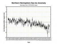
The anomaly is clearly smaller than February 2007.
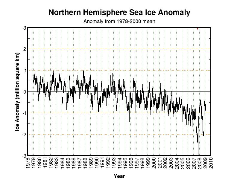
AMSR data agrees with Cryosphere with the 2nd or third highest level in the 9 years of record.
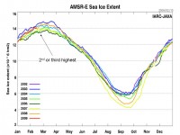
Larger image here.
Note: Anthony Watts on Watts Up With That has posted on this issue with a response from Dr. Walt Meier at NSIDC that the error related to satellite imaging dropout, mainly ice in Hudson Bay that went “missing” in the scan. Anthony explains why posting on these data discrepancy, questioned by Dr. Meier is valid.
See also NSIDC’s description of the problem, a failing satellite and why they chose to continue to use the older DMSP SSM/I data satellite data than to go to the newer more reliable and accurate satellite AMSR-E here.