


The temperature and precipitation pattern for December 2010 matched what is expected from the negative Arctic Oscillation, especially east of the Rockies.
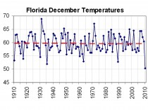
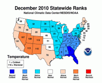
Florida and Georgia had the coldest December in the 1895-2010 record and the Carolinas ranked 3rd coldest. A total of 11 states from the Ohio Valley to the Gulf Coast had the tenth coldest, or colder, December in 2010.
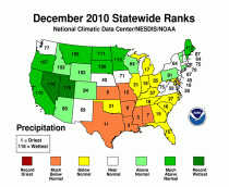
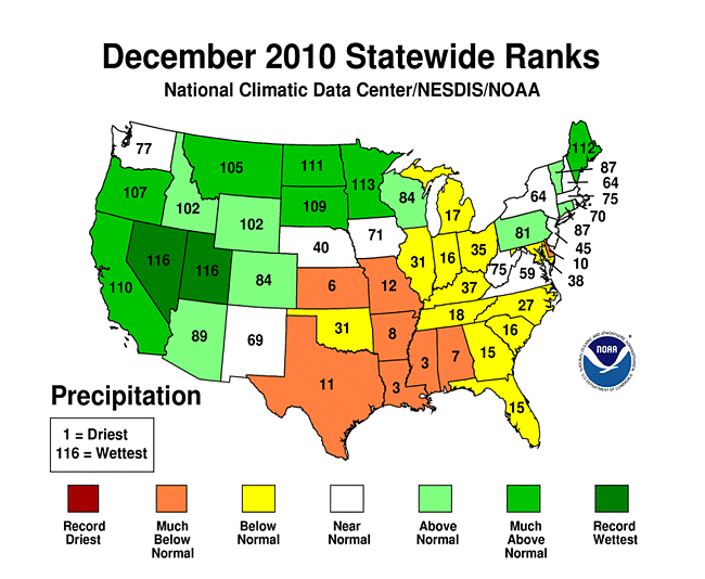
Precipitation was below normal from the Southern Plains and Southeast to the southern Great Lakes, with Louisiana and Mississippi having the 3rd driest December and 4 other states ranking in the top ten driest category.
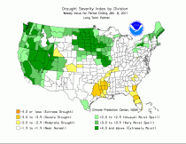
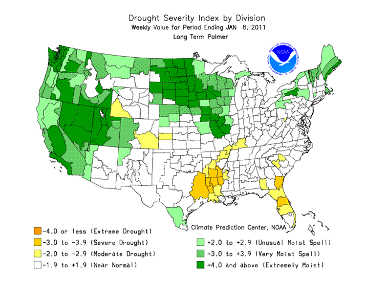
As a result, drought expanded in the southern tier states, especially the southern Plains and Southeast. By the end of the month, 24 percent of the contiguous U.S. was classified in moderate to extreme drought, according to the U.S. Drought Monitor. The precipitation pattern over the West reflected a combination of La Nina and Arctic Oscillation influences.
Enlarged here.
Enlarged here.
Temperature Highlights
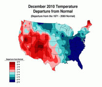
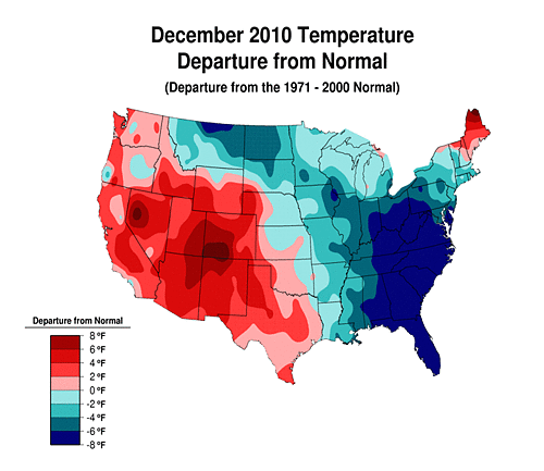
The national temperature, when averaged across the contiguous U.S., was near normal in December, only 0.4 degrees F (0.2 degrees C) below the long-term average.
Regionally, temperatures in the Southwest (2nd warmest) and West (10th warmest) climate regions were much above normal. In contrast, much below normal temperatures dominated the Southeast (3rd coldest) and Central (9th coldest) climate regions.
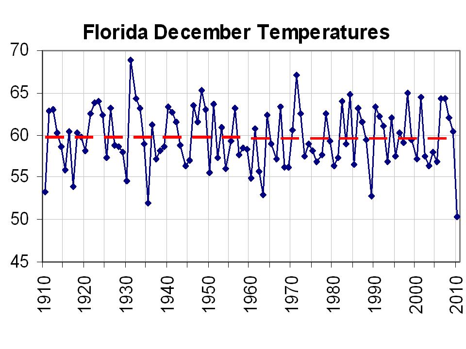
Both Florida and Georgia experienced their coldest December on record. The average statewide temperature in Florida was more than 9 degrees F (5.0 degrees C) below the 20th century average, as every climate division in the state experienced an average December temperature that was record cold.
In addition, several cities including - Miami, West Palm, Ft Lauderdale, Daytona, Orlando, Tampa, and Tallahassee Icecap Note: virtually all cities and stations - had thier coldest December on record.
ICECAP NOTE: For Florida, it was statewide the coldest December on record beating out 1935.
Enlarged here.
Also note that Tampa NWS office in Rusking reported 2010 in many locations in west and southwest Florida had more days with temperatures failing to reach 60F than any year in history.
Several other states including - North Carolina and South Carolina (3rd coldest), West Virginia (4th), Virginia and Alabama (5th), Tennessee (6th), Kentucky (7th), Mississippi (8th), and Ohio (10th) - had a temperature that was among their ten coldest based on records that date back to 1895.
The average temperature for several states in the West during the month of December was much above-normal. New Mexico had its second warmest December, both Colorado and Arizona had their fourth warmest, while it was Utah’s eighth and Nevada’s tenth warmest such December.
Enlarged here.
Precipitation Highlights
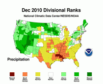
Precipitation in December, when averaged across the contiguous U.S., was normal, only 0.01 inch (0.3 mm) below the 20th century average. Record precipitation amounts in the west were offset by the dryness in the southern Plains and Southeast.
The persistent on-shore flow from the Pacific contributed to the third wettest December for the West climate region. These dissipated by the time they reached the South and East, contributing to the second driest December in the South climate region.
Both Nevada and Utah had their wettest December on record. Other states that were much wetter-than-normal were Minnesota (4th wettest), Maine (5th wettest), North Dakota (6th wettest), California (7th wettest), South Dakota (8th wettest) and Oregon (10th wettest).
In the South and East several states were drier-than-normal as both Mississippi and Louisiana experienced their third driest December on record. Elsewhere, Kansas had its sixth driest December, Alabama its seventh, Arkansas its eighth, and Delaware its tenth.
Enlarged here.
The long term drought index shows the typical La Nina dryness in the south central.
Enlarged here.