


By Joseph D’Aleo, CCM
Snow was in the news a lot this winter in Europe, Asia and the United States. Numerous big cities had a season in their top ten. The storms this week may move some up. We will summarize in April. Even the Sierra has had mammoth snows. See the amazing pictures here.
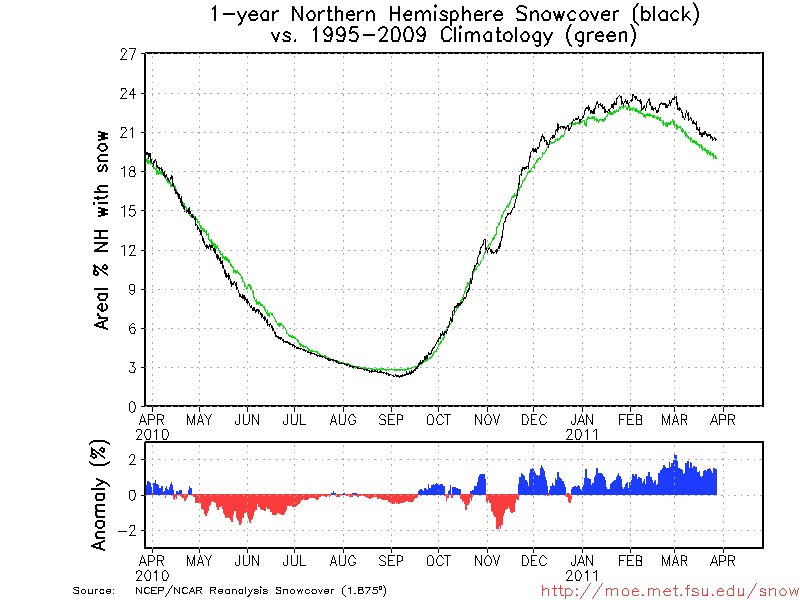
Dr. Bob Hart at FSU maintains en excellent snow lab where he tracks hemispheric snowcover (with just a few day time delay) link.
Here is his plot of the Northern Hemispheric snowcover and anomaly as of March 27, 2011.
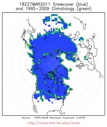
Notice how Asia and Canada are still covered and reflecting increasing insolation and thus still are in the production mode for cold air masses. Here you can see that it remains well above the climatology (1995-2009) as it has virtually continuously since late November.
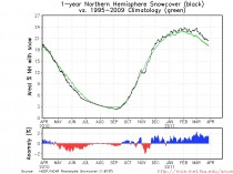
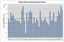
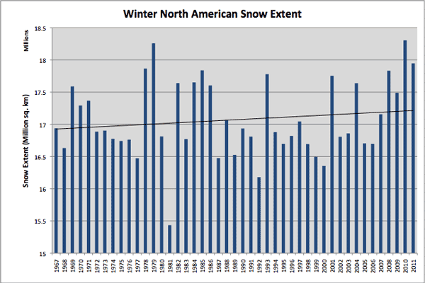
Rutger’s snow lab shows in their seasonal analysis how the snow pack this past winter (2010/11) ranked #3 since records began in 1967 behind 2009/10 and 1977/78. Notice the trend is up for the winter.
The early and persistent snow helped keep the winter in Eurasia and the United States colder than normal.
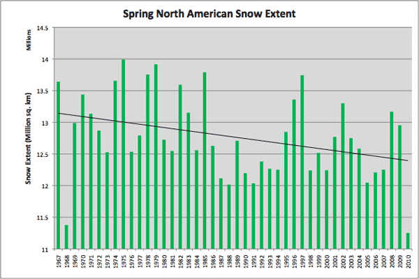
Note last year the snow disappeared from much of the northeast and eastern Canada as persistent maritime flow around record blocking moderated the air enough to remove the snow early. See how last year was anomalously low in snowcover in the spring helping to exaggerate the downtrend.
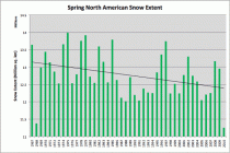
That disappearing act for snow is what started us on a warm spring/hot summer path typical of La Nina summers after an El Nino winter (1999, 1995, 1988, 1966, etc).
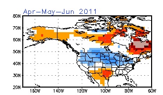
With the spring starting out way ahead of last year, we get support for late cold and snow. We are seeing it in the models. JB and I have discussed the ideas of the cold and snow in late March for weeks and JB has blogged about more for April.
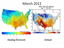
Here is what the analogs had suggested for March and what has happened through the 28th.
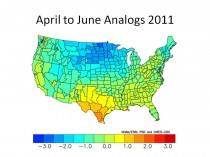
Here is what they suggest for April through June.
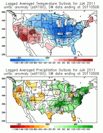
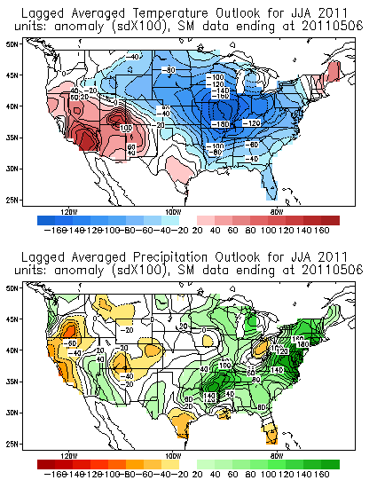
See how the CFS model views April, May June for temperatures

And the Soil Moisture model for April, May and June.
Obviously soil moisture and snowcover are in tune with the global teleconnections and suggest a very different summer than last year. We will fine tune as the indices are updated. It also implies an active tornado season. The cold PDO, La Nina and still warm AMO also point towards more problems from the Atlantic than we experienced last year as JB has posted.
See WeatherBell post here. See earlier post on why increasing snowcover is not consistent with global climate change models here. Also see 30 exqamples of AGW scientists covering both sides of the fence.