


By Joseph D’Aleo
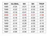
The University of Alabama MSU lower tropospheric data just released showed this May was the 4th coldest May for the globe since that record began in 1979. It was also below the average for both hemispheres. It trailed only 1985, a weak El Nino at the tail end of the El Chichon cold period, 1989, a summer following a strong La Nina, and 1992, the year after Pinatubo. It was just 0.003 colder than 1993, another Pinatubo affected year that ranked 5th.
This year is coming off a strong La Nina and a cold Pacific (negative PDO). Satellite monitoring began in 1979. Had it been available before the Great Pacific Climate Shift, you would find more such cold May years.
See larger table here
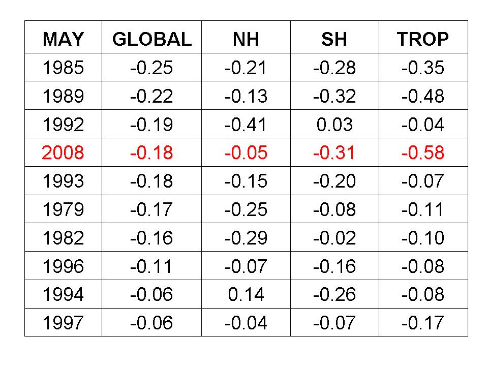
For more than 75% of the nation, according to the CDC, May was cooler than normal, as much as 7.5F below in the far North Central.

See larger map here
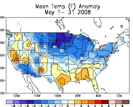
This is in sharp contrast to May 2007 which was warm in the same areas it was cold this year. May 2007 was the 11th warmest May for the US.
See larger map here
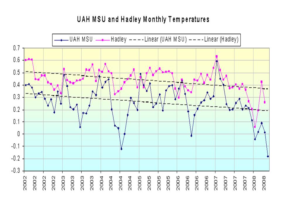
That continues the downslide we have seen starting in 2002 which accelerated the last year with the Pacific cooling and La Nina.
See the larger image here.
The next week will see a sudden arrival of summer temperatures in the east and central United States as the Madden Julian Oscillation (MJO) is in a location that favors a western North American trough and the building of a southeast and south central ridge. After mid-month, the MJO should advance to a spot favoring the trough coming east and the ridge backing up to the south central and Rockies/Intermountain. The heat will retreat west gain and more normal June readings will return to the east.