By Joseph D’Aleo
Thanks to Spaceweather.com for coverage of this eruption that follows:
Perfect timing. On June 12th, just as Russia’s Sarychev Peak volcano was erupting for the first time in 20 years, the International Space Station flew directly overhead. Astronauts had their camera ready and snapped one of the most dramatic Earth-science photos ever taken from space.
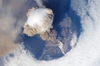
Researchers are studying this rare photo to learn about the early stages of powerful volcanic eruptions. A few phenomena stand out.
(1) The volcano erupted with such force, the plume actually punched through the atmosphere. Note how clouds around the volcano have parted in a circular ring--that is a result of a shock wave produced by the upward blast (ICECAP NOTE: more likely subsidence surrrounding the rapidly rising air in the plume). (2) The plume is a mixture of brown ash and white steam. A “dirty thunderstorm” complete with lightning could be in progress within the roiling cloud. (3) The smooth white bubble on top of the plume is probably a mass of water condensing from air shoved upward by the rising ash column. If so, it is akin to the iridescent pileus clouds sometimes featured on spaceweather.com.
If you’re not amazed yet, try this: Put on a pair of red-blue stereo glasses and behold the eruption in 3D. The anaglyph was created by graphic artist Patrick Vantuyne of Belgium. No stereo glasses? A cross-eyed version is also available.
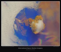
Sarychev Peak is a stratovolcano covering almost the entirety of Matua Island in the Kuril Islands, which belong to Russia’s Sakhalin Oblast, south of the Kamchatka Peninsula. It is a young, highly symmetrical stratovolcanic cone with an elevation of 1496 m.
One of the most active volcanoes in the Kuril Islands, on June 12, 2009, it released two large ash plumes. One plume of ash spread about 105 km (65 mi) toward the west-northwest, reported the U.S. Air Force Weather Agency, and the other reached 250 km (155 mi) toward the east-southeast.
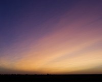
People across the USA are reporting unusual sunsets. When the sun goes down, delicate ripples of white appear over the western horizon. Then, as the twilight deepens, the sky turns a telltale shade of “volcanic lavender.” Paul Hadfield photographed this example last night, June 28th, from Latham, Illinois:
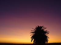
Rafael Gallego, Carrion de los Cespedes, Sevilla, Espana (Spain) June 30, 2009
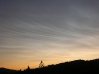
Paul Laak, Republic, Washington, June 30, 2009
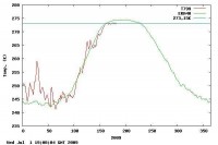
This animation shows the rapid spread of the sulfur dioxide around the high latitudes. Icecap Note: It will add to whatever sulfate aerosols remain from Mt. Redoubt this spring. That may contribute to less sunshine (already feeble in high latitudes especially now near this very quiet solar minimum) reaching low levels this summer and thus less melting. It may explain why arctic temperatures according to DNI Center for Ocean and Ice are hugging the melting point a few degrees below the normal for late June.
See larger here.


