


By Joseph D’Aleo, CCM
The warming NASA remarked about in the story below this fall in northeast Canada and Hudson Bay is part of the very strong negative arctic oscillation pattern we have seen the last few years, in part related to the long solar minimum and high latitude volcanoes.
Enlarged here.
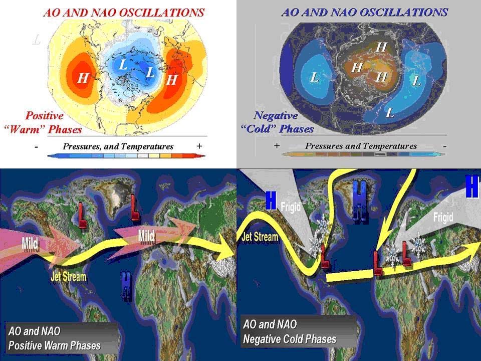
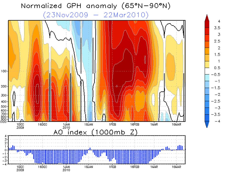
Last winter saw the most negative AO of the record back to 1950. It persisted in the negative state from early December to the first day of spring.
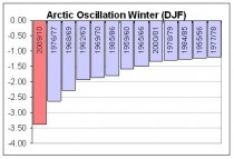
Enlarged here.
The global anomalies with a negative winter AO are as follows:

Enlarged here.
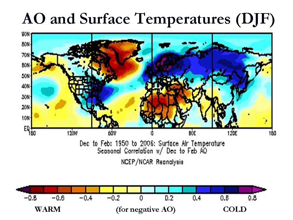
See how well that verified this past winter. No GHGs need apply.

Enlarged here.
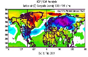
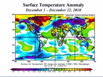
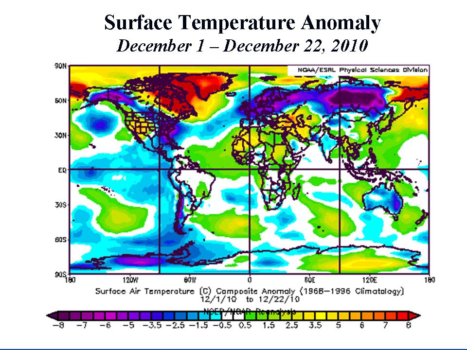
NOTE AMAZINGLY how even though we have replaced the strong El Nino with a strong La Nina, the result so far has been virtually the same for the start of the Northern Hemisphere winter. It is even colder in the southeast US, in Alaska and India. In the southern Hemisphere note the cold December to date in Australia and much of South America (the start of their summer). Summer snow even fell in southeast Australia.
Enlarged here.
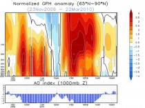
The cross section through the polar region last year (above, enlarged here) showed the strong stratospheric warming favored in low solar east QBO (Quasi-biennial Oscillation) winters.
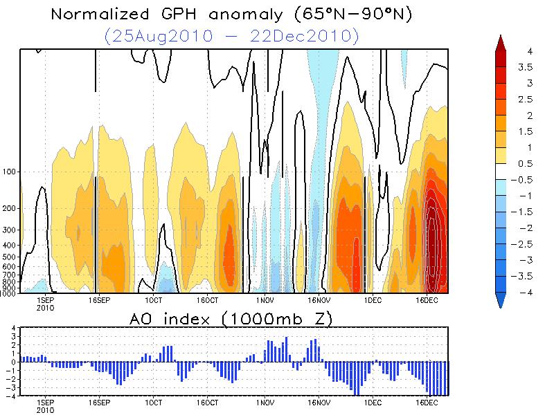
This year the QBO is west, which doesn’t favor stratospheric warmings but doesn’t prohibit polar warming in the troposphere (like we saw in 1995/96). This blocking then is more intermittent with blocks moving west being absorbed into the upstream mid latitude ridges and then reloading in the eastern Atlantic to Scandinavia and retrogressing westward. You can see that here in the cross section through the third week of December.
Enlarged here.
Note the AO is again off the charts (5 STD negative at times). It is forceast to diminish but then reload in a few weeks. Note also how the warmth is lower, at pressures above 100 mb compared to last year. To be effective in our weather it has to reach down to jet stream and middle troposphere - the case in both years.
At the end of blocking episodes when the blocks enter Canada, often there is a major nor’easter along the east coast as is forecast the next few days. The storm that will become the nor’easter brought a rare white Christmas to parts of the southeast. In Europe, snow and cold continues to disrupt holiday travel by air, rail and road.