CTV.ca News Staff
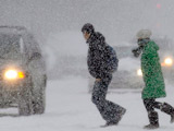
The first day of winter brought wind-chill warnings, snow and a bevy of storms to cities across Canada on Sunday, potentially laying the groundwork for the first cross-country white Christmas in nearly four decades. Environment Canada senior climatologist David Phillips told CTV Newsnet that “it looks like a very good chance” it will be a white Christmas for all parts of Canada for the first time since 1971.
“It’s just sort of the beginning of winter, and it’s a little much to expect when we have so many different climatic types in this country for it to be frozen and snow-covered from right across the huge country,” he told CTV Newsnet on Sunday. But with so much snow already on the ground, the veteran weather prognosticator said he thinks that any upcoming balmy Christmas Day temperatures will not be able to melt away the growing snowfall base. It may be in 40 years, the first one,” he said.
As for Sunday’s weather conditions, Phillips didn’t mince words. “In 10 provinces, every one of them has got some weather misery out there, and an advisory,” he said. “About the only areas not showing any advisory or warning situations are the Yukon, Northwest Territories and Nunavut.” Environment Canada snowfall warnings for Vancouver predict that up to 20 centimetres of snow will fall by Sunday evening, accompanied by bone-chilling wind-chill effects throughout the evening and into Monday. Environment Canada meteorologist Geoff Coulson told The Canadian Press that the Prairies would see very low temperatures, falling into the -30s by Sunday evening.
The storm system that began in southwestern Ontario Sunday morning has left as much as 20 cm of additional snow in some areas, and is now making its way eastward. However, much of the region is still under blowing snow warnings thanks to high winds that could gust up to 90 kilometres per hour. According to the Ontario Provincial Police, the morning snowfall caused more than 100 minor collisions north of the Toronto area between 6 a.m. and 9 a.m. Sunday. And at Pearson International Airport, dozens of flights were delayed on Sunday morning—though the runways had mostly been cleared by the afternoon.
With the storm system moving eastward through Sunday afternoon, parts of eastern Ontario, Quebec and much of the Maritimes remain under winter storm or snowfall warnings. Environment Canada predicts as much as 20 cm of snow to fall in Montreal and 30 cm of snow in other parts of Quebec by the end of the day. Some 40 flights were cancelled at Montreal’s Trudeau Airport on Sunday, and train passengers were experiencing half-hour and hour-long delays.

The weather was bad enough on Highway 40, near L’Assomption, Que., that at least 30 cars became embroiled in chain-reaction accident. Both New Brunswick and Newfoundland were expected to see snowfalls of between 10 and 25 cm, with high-speed winds accompanying some storms. Phillips said some parts of the country are seeing snowfall amounts that have outpaced last year’s record and near-record totals at this point in the season. But he also said it’s unlikely that trend will continue. “Already in many places in eastern Canada, we’re ahead of the record from last year,” he said. “But, you know, we have a long, long way to go. I’m thinking that, hey, there’s not enough left in nature to give us another one of those years.” Read more here.
See also this paper thanks to Willie Soon on the heavy snow in Victoria in British Columbia.
Meanwhile Snow paralyzes eastern and central Turkey.


