By Joseph D’Aleo, CCM
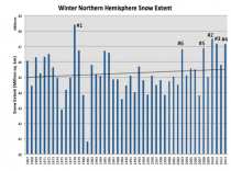
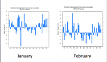
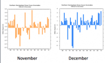
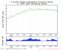
Rutger’s monthly snow data is in. November was 5th snowiest, December was the snowiest ever, January the 6th snowiest and February 16th snowiest. The winter as a whole was 4th snowiest.
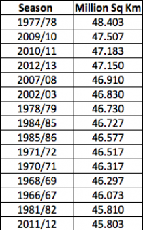
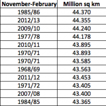
As a whole the winter ranked 4th behind 1977/78, 2009/10, 2010/11, (2012/13) and ahead of 2007/08 and 2002/03. That means 5 of the top six snowiest winters for the northern hemisphere have occurred since 2002/03. When i averaged Novermber to February, 2012/13 jumped to #2.
In the November to February average, 2012/13 jumped to #2.
If the snow keeps coming the next few weeks, I suspect November to March will become #1.!!!!
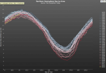
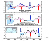
Oh and the arctic ice is near the middle of the pack. Still given the warm AMO, it should be low again next summer. The AMO is the driver for the cyclical changes in ice (see more here).
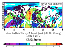
By the way, to counter the alarmist knee jerk claims that this is due to warm air which means more moisture which means more snow, here is the mean precipitable water for the northern hemisphere since February 1, when it turned snowy in the U.S. As you would expect when it gets cold, (necessary for snow), the amount of water vapor in the air drops. Blues are below normal, yellows and reds above.
