

Joseph D’Aleo, CCM, AMS Fellow
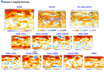
As is frequently the case, the climate models can’t forecast even a month ahead. Similar models are run 100 years into the future. We are supposed to believe they are accurate. I could name a dozen reasons why they w 814temp ill not be. They tell us they will go to faster computers and higher resolution but that simply produces higher resolution noise.
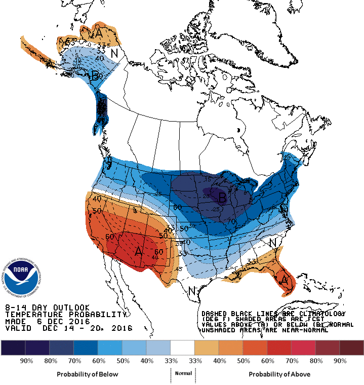
CPC forecasters did see some potential at the end of November for some cold in the northwest.
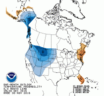
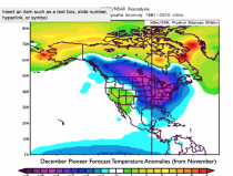
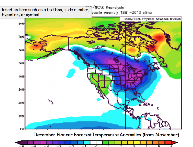
But WeatherBell’s statistical Pioneer model in November saw a much colder December.
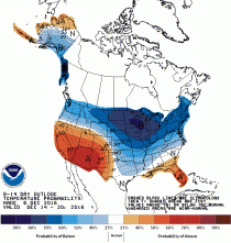
CPC came around to that cold mid month (they had it cold the next week) in their 8-14 day Tuesday.
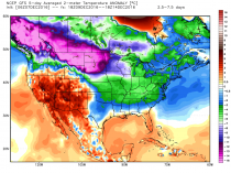
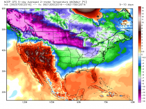
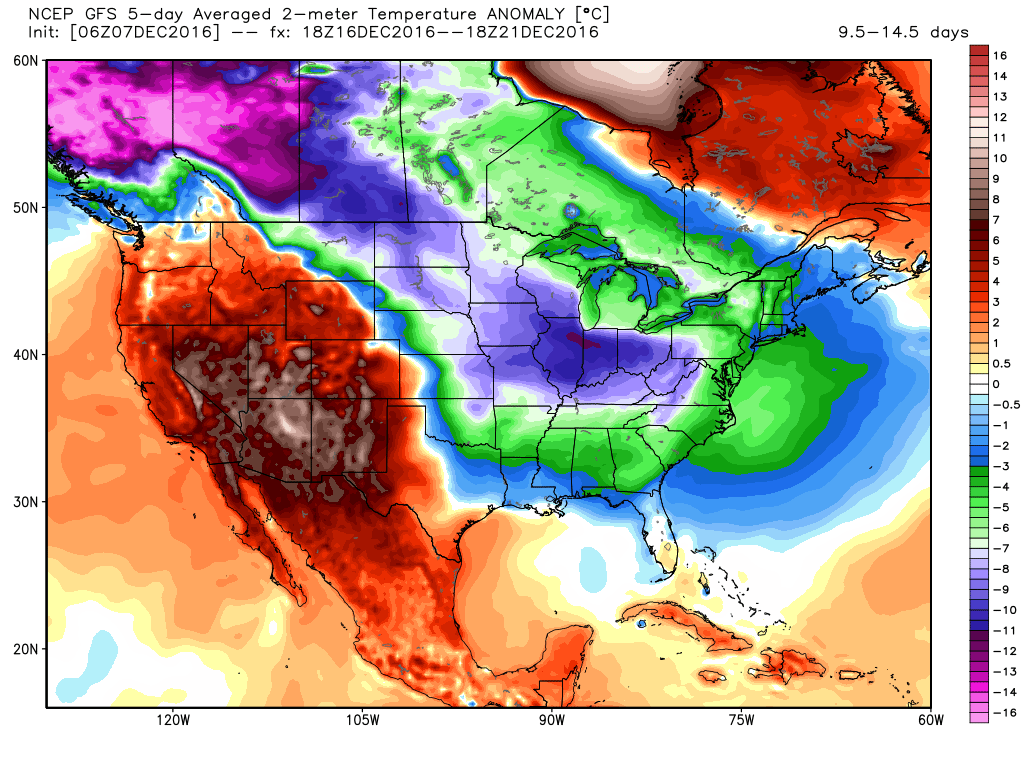
The models show brutal cold the next 15 days - these are anomalies of near surface temperatures in degree celsius (they show anomalies of -40F or more in the core of the cold!)
These next three maps are 5 day increments:

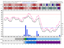
Here is what we call a Meteogram for Chicago O’Hare from the US GFS model. It shows three sub zero day with lows near -10F. The usually more accurate European model takes them to -15F!
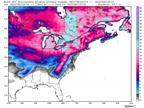
The many days of extreme cold crossing the warm Great Lakes will bring historic lake effect snows. Expect broadcasters and newspapers spouting the liberal lines and the AMS/GMU doctrine standing on the snowbanks and blaming it on global warming.
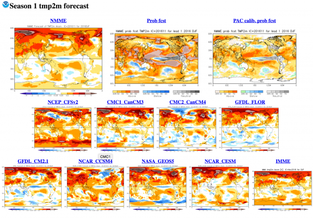
Here is a link to slides showing how the statistical models we use that includes factors the dynamical models ignore beat the dynamical models and official forecasts in recent years.
If you are in a weather sensitive industry, you should take a look at Weatherbell.com and follow our model, our (Joe Bastardi and I) daily blog posts and videos through this incredible stretch and winter.