

Joseph D’Aleo, CCM, AMS Fellow
WeatherBELL Analytics, LLC
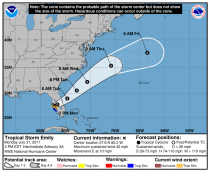
A weak tropical storm Emily came ashore in Florida this morning.
It will cross into the Atlantic and maintain tropical storm intensity according to NHC.
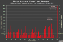
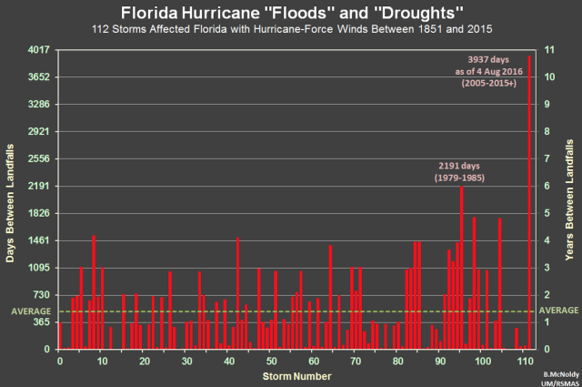
The chart above shows the intervals between major hurricane landfalls in Florida as of August 4, 2016. A year later, we will be now at an amazing 4302 days, twice the original record.
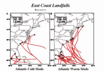
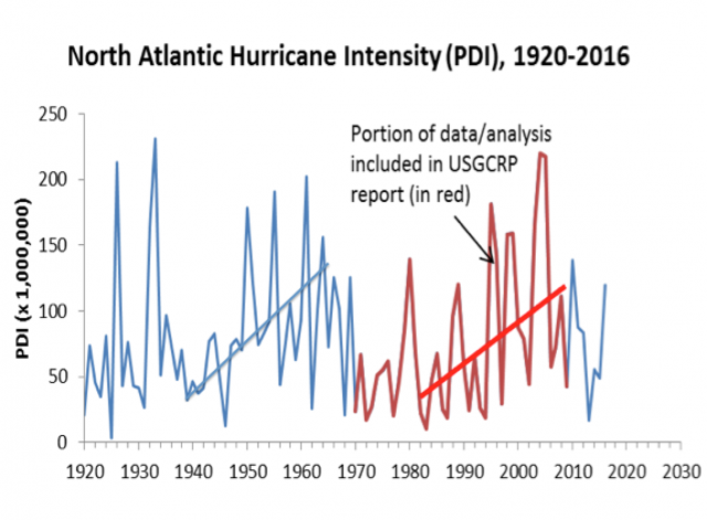
You can see cycles in Atlantic hurricane intensity.

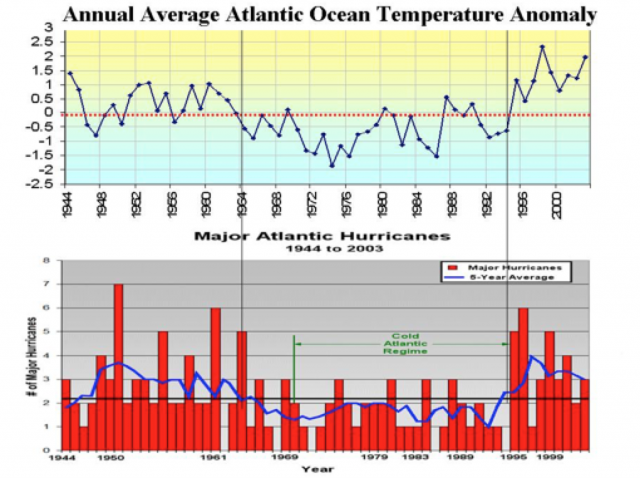
The hurricane activity in the Atlantic is tied to cycles of the Atlantic AMO warm and cold modes.

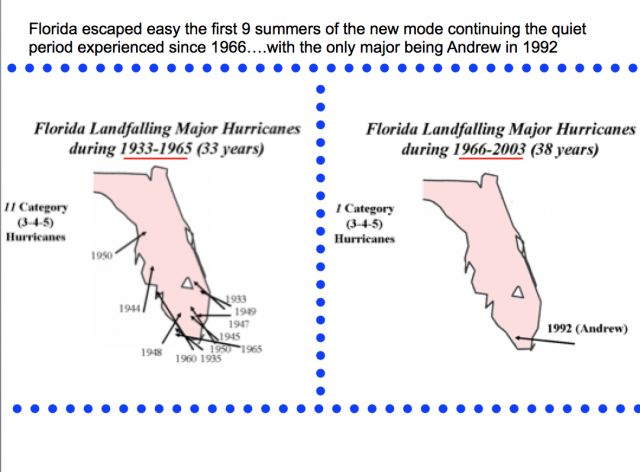
See the frequency of major hurricanes and landfall in the warm and cold modes.
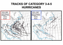
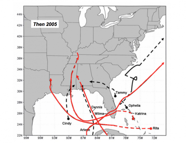
Florida peninsula escaped a major landfall during the first 9 summers of the latest warm mode starting in 1995.
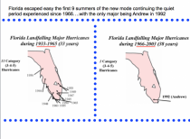
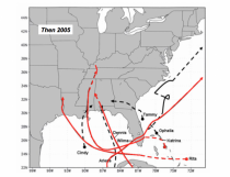
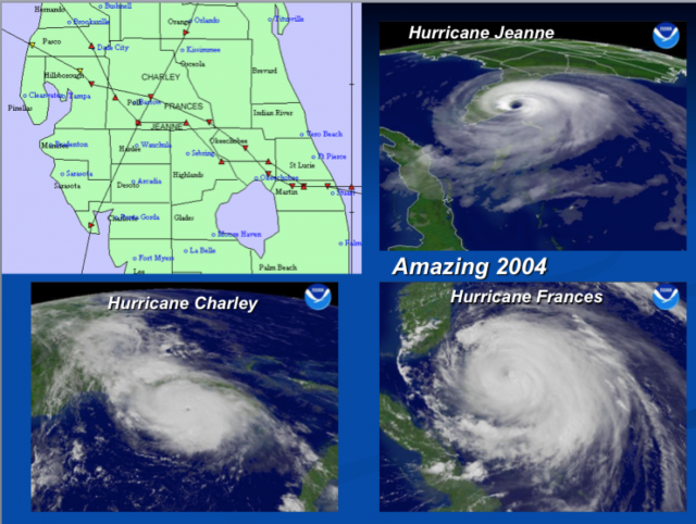
Then came 2004 with three storms and in the panhandle Ivan and then Wilma in 2005.


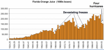
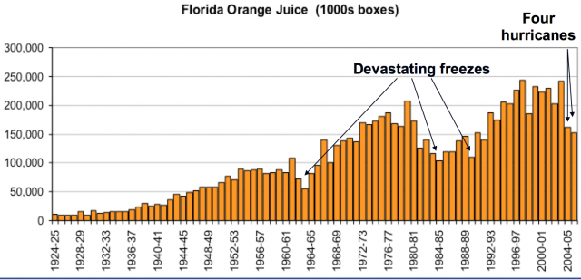
The four significant hurricanes hurt citrus like 1960s and 1989s devastating freezes.
The current SSTA pattern in not like 2004 in the North Pacific though it was similarly Modoki-like in the tropics and somewhat similar in the Atlantic.
See the difference.
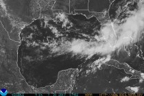
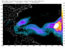
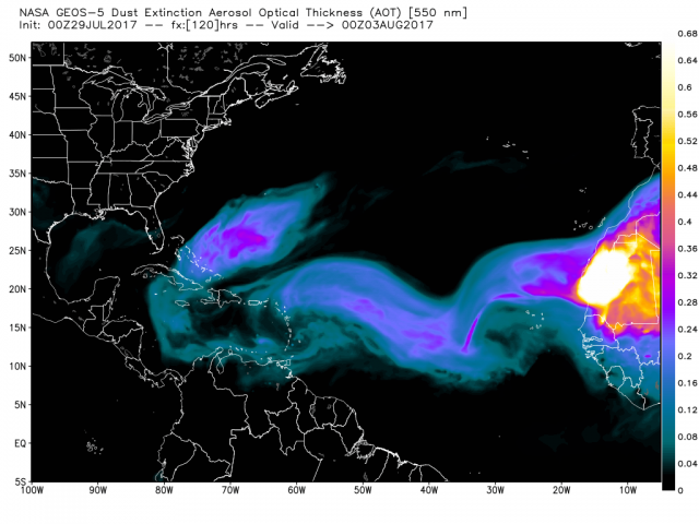
We will battle Saharan Dust a while longer. Usually Atlantic pressure changes diminish that by mid August. The season rises quickly to a peak around September 10.
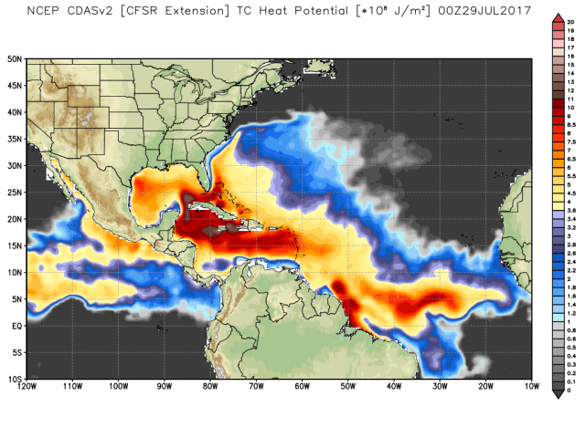
See the western Atlantic and Caribbean are primed with high ocean heat content, typical of the late summer.
