


By Nelson Lampe
In Montana, the Army National Guard dispatched two helicopters to help locate motorists stranded by a snowstorm in the southeastern part of the state. “We do know we have some motorists out there, but we don’t know where. So we have a serious situation,” said Charity Watt Levis, a spokeswoman for the Montana Department of Transportation.
Crews rescued stranded motorists, including a family of three, that had been trapped on a highway in northeast Wyoming. Up to 30 inches of snow had piled up in South Dakota’s rugged Black Hills, and the storm system also had generated tornadoes. The blowing snow cut visibility and piled in drifts as high as 4 feet in parts of Wyoming. See KELOland video here.
“We have wind gusts to 62 mph at Valentine this morning,” said National Weather Service meteorologist Clifford Cole in North Platte, Neb. A wind gust was clocked at 90 mph in Perkins County, S.D., on Tuesday, and Hettinger in southwestern North Dakota measured a gust to 55 mph.
The weather service posted blizzard warnings Tuesday for western sections of South Dakota and Nebraska, eastern Wyoming and the southeast corner of Montana. Much of western South Dakota was shut down Tuesday for a second day, with Interstate 90 closed from Chamberlain to Gillette, Wyo., a distance of 345 miles. The South Dakota Transportation Department reopened the route Tuesday night.
Visibility was so poor that the South Dakota Department of Transportation pulled snowplows off the roads. “It’s a safety concern primarily,” the DOT’s Gary Engel said. “In the November blizzard we didn’t do our closure quite as soon in that one, and we had trucks stopped right on the road. We had trucks stuck in the ditch because they couldn’t see where they were going.” Read more here.
The snowmelt after what was in parts of the Northern Plains an all-time snowiest winter, has already produced some major river flooding mainly across the Red River. Forecasters say that the Red River of the North in Fargo and Grand Forks, N.D., will ultimately reach major and possibly all-time record flood stage and has a strong likelihood of a crest measuring among the top five highest on record. Away from rivers, widespread over-land flooding is expected due to the flat terrain and frozen drainage networks in the Red River Basin. The threat in this area was so great that the National Weather Service created a new category - “High Risk” - to distinguish it from the existing “Above Average” category for flooding potential. Flooding occurred in this area in 1997 after a very snowy winter and early spring after a second year La Nina like this one. This event is said to be a “100 year” flood in parts of the area.
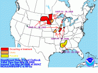
Larger image here.
Meanwhile, after some early spring like warmth, an early spring snowstorms is in the cards for the central plains including the drought stricken western high plains from Colorado and western Kansas south to the Oklahoma and Texas Panhandles. 12 plus inches is likely to fall Friday to Saturday.