


By Joseph D’Aleo, CCM, AMS Fellow
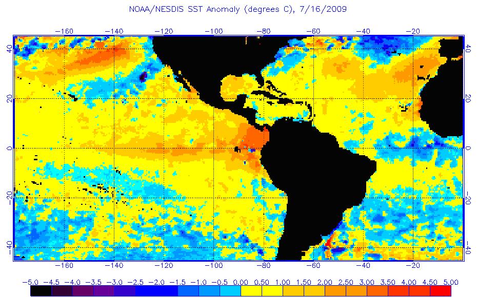
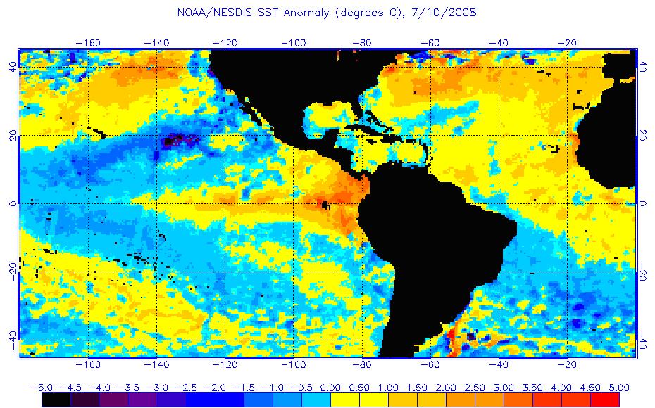
The official El Nino criteria has been met. Now the meteorological world looks to see how strong and how long this lasts. Count on CPC and other forecast centers to go for a warm winter as a result of El Nino but as we have shown, there are differences in El Ninos depending on the overall mode in the Pacific Basin (the PDO). The tropical Pacific sea surface temperatures this week are shown here.
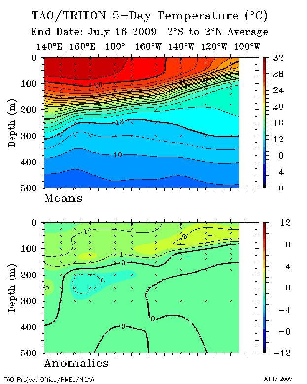
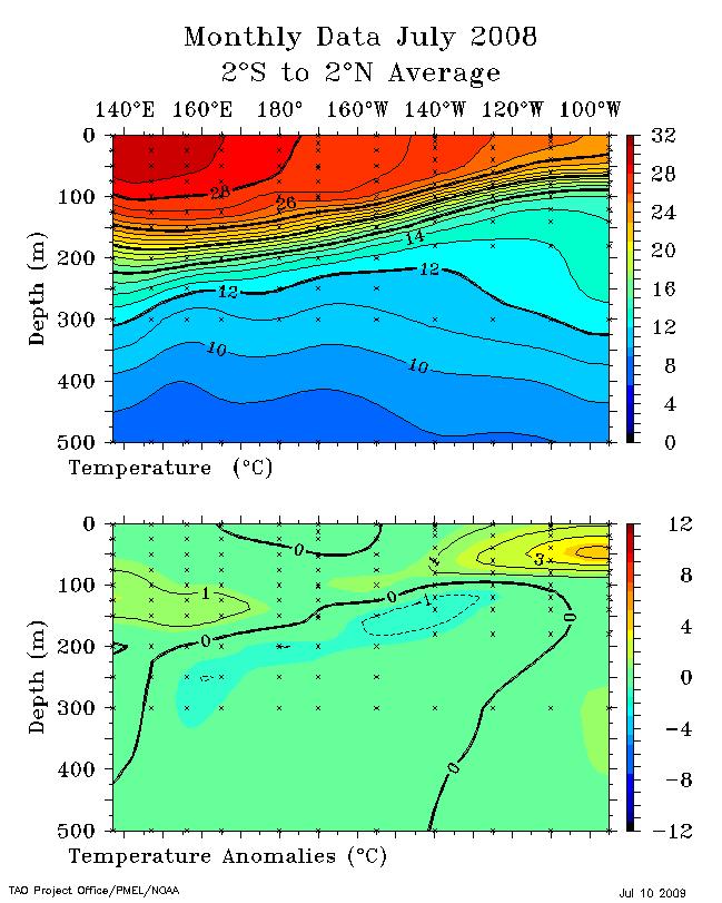
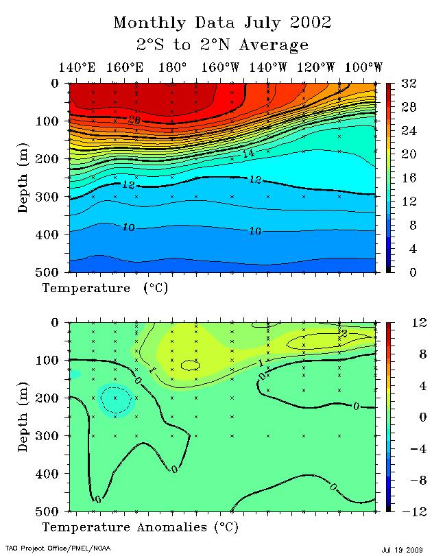
You can see the warm plume along the tropical easterly belt along the equator. The depth cross section shows the pool of warm water that has suppressed the thermocline in the eastern Pacific enlarged here.
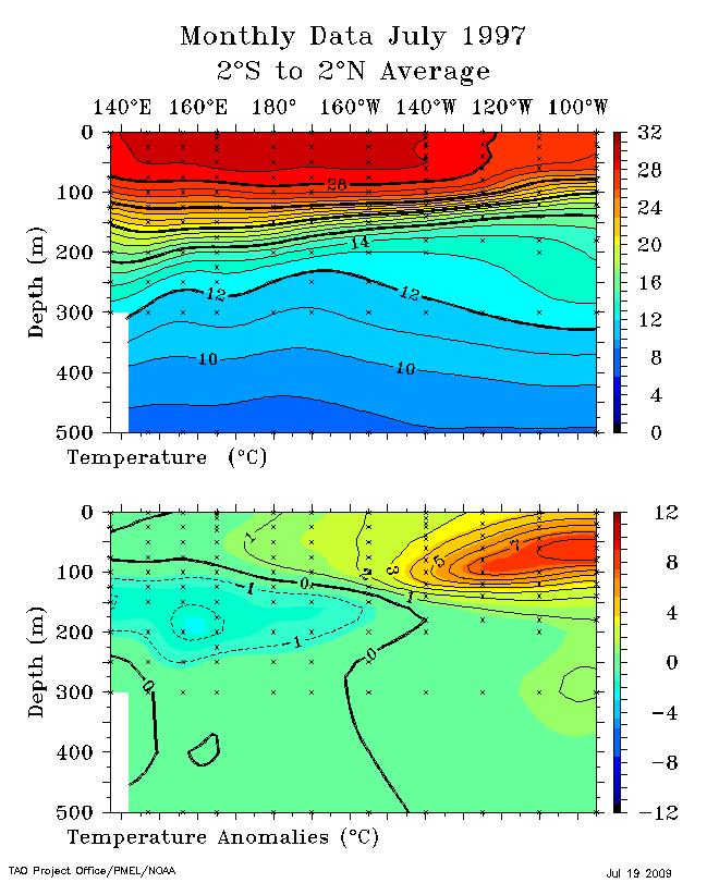
The oceans tried this last year in the early summer, but the warmth stayed in the eastern Pacific (enlarged here).
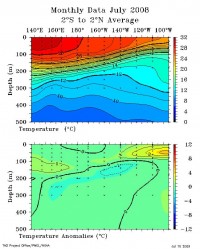
The cross section looked similar last July to the one this last week although it was a little colder in the central Pacific near the surface and beneath the thermocline. See larger here.
See an animation of the ocean temperatures over the last years as the feeble El Nino attempt failed, La Nina returned and then El Nino developed here.
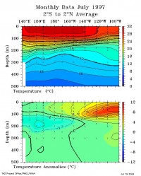
The El Nino of 2002/03 was another similar year. 1997/98 was dramatically stronger at this point of the preceding summer. Compare with the super 1997/98 event in July 1997 (enlarged here).
What’s Different
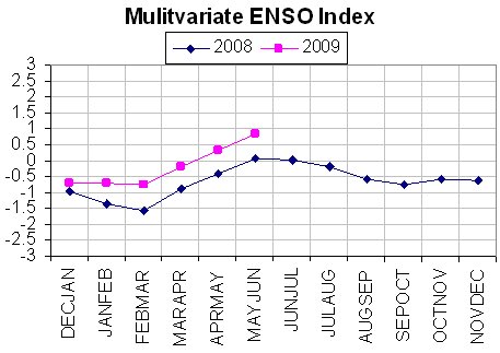
The CDC’s Multivariate ENSO Index shows this year’s warming is stronger than last year but tracking along a similar path. (larger image here)
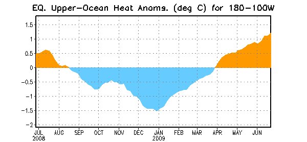
The ocean heat content east of the dateline in the tropical Pacific is also greater this year. However sub surface anomalies have diminished the last few weeks and the heat content here shown may soon peak. The Southern Oscillation Index has been positive (La Nina territory) much of the last month. Is it possible like last year, the warming fails to persist? I suspect it will continue to come on become a weak to moderate El Nino that peaks perhaps before winter.
Enlarged here.
El Ninos in negative PDO eras tend to be shorter, weaker and colder (USHCN GISS version -0.12F) compared to El Ninos in a positive PDO era (+1.08F). Some of that is the data contamination (siting) issue which is greater in the recent +PDO era 1979-1998 than in the prior cold PDO 1950-1978. The ENSO models see this as a stronger event but with some hints it may peak before winter. See those forecasts and also related changes to the PDO, AMO and the possible implications here.
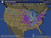
Also see more evidence of the cold summer typical of onset El Ninos in this map plot of the stations with 651 record low and 868 record low maxima temperatures for the US the last week courtesy of Global Freeze.
**********************
The Morality of Climate Change: (Uploaded 18 July 2009)
One has to know all the facts to determine the morality of an issue. John Christy on CO2Science.org, below and enlarged here.
See this town hall attack on Mike Castle, one of the Republicans who voted FOR Cap-and-Trade below.