


By Joseph D’Aleo, CCM, AMS Fellow
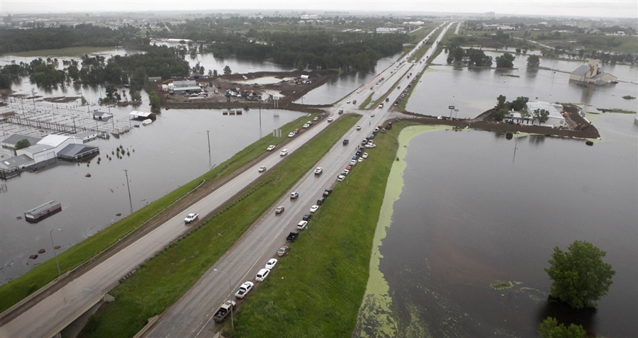
Flood waters continue to increase into Minot, N.D., with about 15-20% of the city inundated with water and flood waters expected to increase in the coming days. About 12,000 residents have been evacuated from the previously-identified flood zones. Officials are considering additional evacuations as projections worsen. Water is flowing toward Minot from Canada faster than ever, due to record water levels upstream. The current forecast is for the crest to reach between 1,564 and 1,565 feet above sea level sometime during the overnight hours of June 25-26, and continuing through June 30. This crest would be more than 6 feet above record flood stage, and 9 feet above major flood stage.

Of course, there will be some like ‘Stagecraft Tim Wirth’ who milked this hoax into a lucrative UN post who proclaim this is further proof of global warming, which they project results in more moisture and extremes of flooding and drought. They claim spring snowmelt comes earlier resulting in rapidly disappearing glaciers.
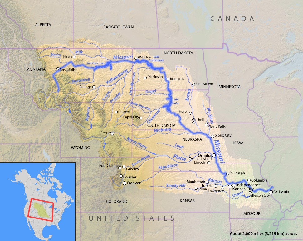
The data shows they are wrong...again. Here is the Missouri River Basin stretching from the Northern Rockies through the northern Plains to the Mississippi.

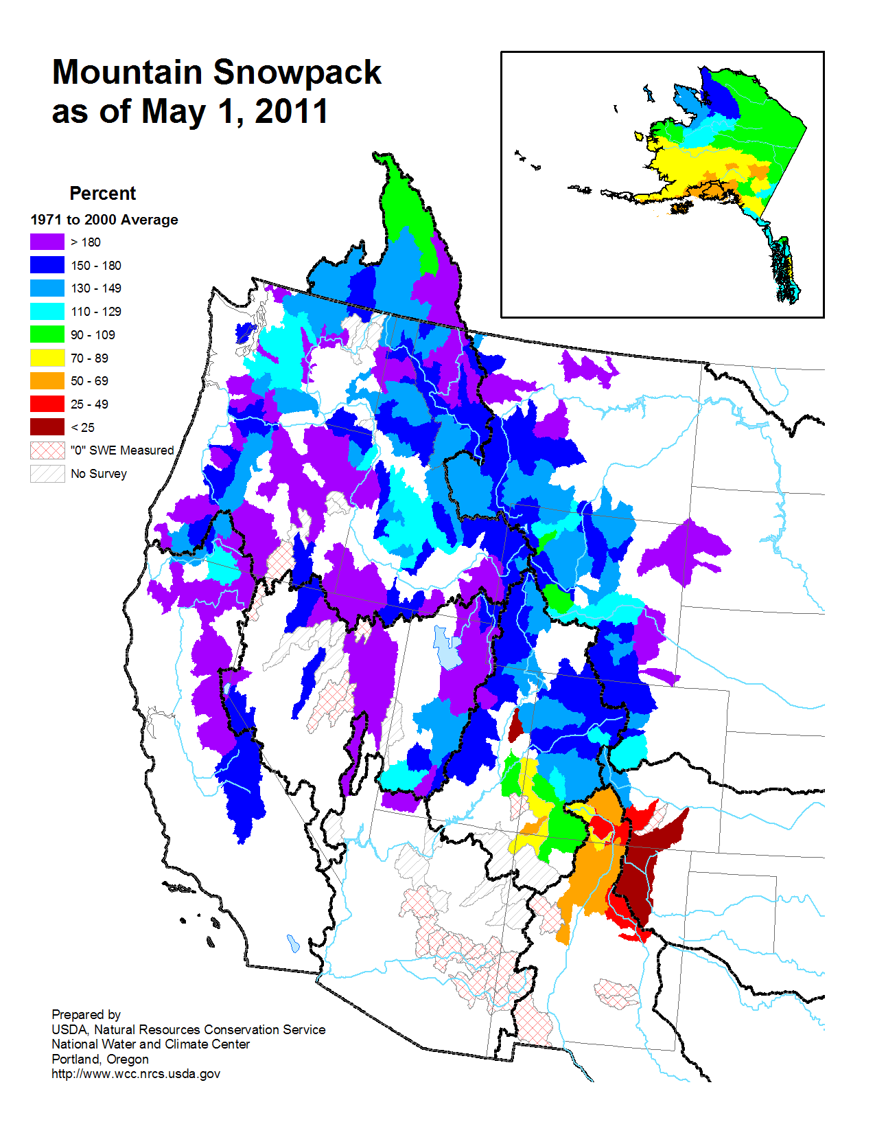
Here was the snow water equivalent as of May 1, 2011. Only southernmost Colorado and New Mexico and Arizona had below normal snow packs and water equivalent in the snowpacks.
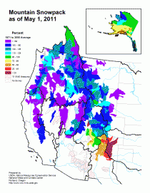
Enlarged.
Many areas of the west had over 180% of the normal. Snow still is abnormally very deep in parts of the mountainous west. The melting of the snow coinciding with heavy rains this spring as the same active La Nina storm track shifted slowly north is what brought the flooding (90 day anomalies of over 16 inches).
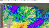
Enlarged.
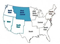
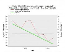
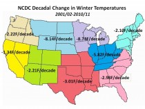
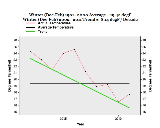
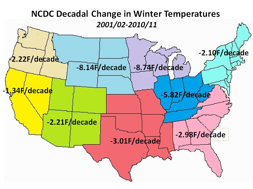
So why is this not the result of global warming. WELL, BECAUSE WINTERS ARE COOLING....AT THE SECOND FAST DECADAL RATE OF ANY PERIOD SINCE 1895!!! (8.14F/decade or 81.4F per century! - only the decade ending in 1950 had a slightly greater cooling, a -0.85F/decade). This is true in the Missouri River basin and the country as a whole (with a cooling of 4.13F per decade) Here is the winter trend the last decade for the NCDC North Central Region over which the Missouri River flows - Montana, Wyoming, North Dakota, South Dakota and Nebraska.
On Weatherbell.com last week, we followed this up with a detailed analysis of temperature trends in all 8 NCDC climate regions for the winter.
Every one of the 8 regions has shown significant decadal scale cooling. Cooling results in a squeezing out of moisture from the air. All condensation is the result of a cooling not a warming process - water droplets condense on the outside of ICE WATER not HOT COFFEE.
this region was not alone. In fact all 8 US NCDC regions showed cooling the last decade in winters (PDF).
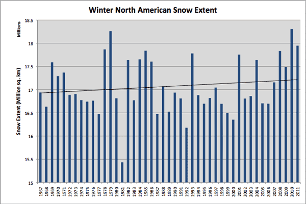
The hemispheric snowpack has been increasing during this cooling. This last winter was the third greatest for the Northern Hemisphere behind 2009/10 and 1977/78 and just ahead of 2007/08. See a pattern. COOLING IS HAPPENING AT AN ALARMING RATE.
Enlarged.