


By Anthony Watts, Watts Up With That
My post How not to measure temperature, part 51 was also cross posted over at Climate Audit, and has created quite a stir when Atomz, a climate scientist at the University of Arizona, tried to demonstrate that the temperature spike shown in the GISS data at Lampasas, TX, was not due to the relocation next to a building and asphalt parking lot, but rather some problem with GISS algorithm to do homogeneity adjustment to the data.
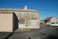
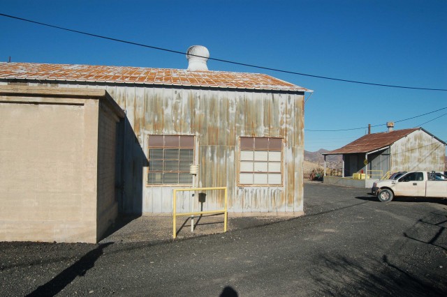
Steve McIntyre had doubts and posted a tongue in cheek rebuttal where he blamed the problem on UFA’s (Unidentified Faulty Algorithms). It seems reasonable given the fact that Arizona is already the center of surface measurement weirdness given the parking lot weather station operated by the Atmospheric Science Department of the University of Arizona. Enter serendipity. Warren Meyers son Nicolas, has been actively surveying Arizona stations for his school science project. My inbox had a new station from him today, Miami, AZ. So I decided to take a look at it. As is typical when an MMTS sensor gets installed by NOAA/NWS to replace the traditional Stevenson Screen, it got closer to human habitation, and in this case, a LOT closer. Too close I’d say.
See full size here
So I though I’d take a look at the raw GISS temperature plot for Miami, AZ to see if the move would show a spike, it did. (Anthony overlaid the homogenized NASA GISS data after adjustment over the raw data as he had done with Lampasas, Texas.)
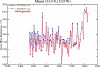
See full size graph here
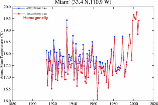
Notice that after the GISS homogeneity adjustment, the past temperatures go down, thus making the slope of the temperature trend rise. The rise is purely artificial, and appears to be an artifact of data adjustment by NASA GISS on this rural station.
In a comment on the subject, Steve Mosher offers an explanation: “In Hansen 2001 Hansen says he uses nightlights to determine if a station is Rural in the US and population everywhere else. Miles city population is less than 10K which makes it rural, BUT, nightlights (satellite imagery taken in 1995) indicates a brightness factor for Miles of 26! effectively making it urban.”
I concur, there appears to be a flaw in the GISS nightlines methodology and adjustment algorithm. I look forward to seeing GISS investigate, and if this problem is indeed verified, a dataset correction. See full post here.
UPDATE: see yet another example of the GISS adjustment issue for a rural station with a good record and little in the way of station moves, and that had changed little in 100 years, Cedarville, CA here.