


As a follow-up to the posting on the NOAA/NASA data debacle, three posts worth your attention courtesy of posters and commenters on Watts Up With That. First John Goetz has another excellent post called Cedarville Sausage. Then there is a guest post from an old-time observer Fabricating Temperatures on the DEW Line. The third is this post about data in the State of Maine by a volunteer John Simmons, for surfacestations.org, working with the Kristen Byrnes foundation.
Everyone has heard the term, “creating something from thin air.” Now there is a new term, “creating climate data from junk.” Last summer, volunteers from the Kristen Byrnes Science Foundation completed surveys of the United States Historic Climate Network (USHCN) temperature stations in Maine that are used to measure Global Warming. The results of the station surveys were astonishing and reinforced results from the rest of the country; there is a huge quality problem with data used to support the current global warming theory. Over 44% of the 1221 USHCN stations have been surveyed, and 89% of those are improperly located. Additionally, a statistical analysis of the remaining stations shows them to be warmer, so the worst are yet to be surveyed.
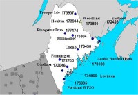
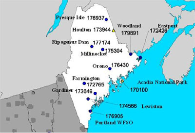
Map of Maine with temperature stations by name and NCDC ID #. See larger map here.
None of the stations in Maine were free of microclimate or urbanization biases. 8 examples are provided along with images in this post. The station at Orono, Maine pictured below is located on the roof of a 4 story university building near a, chimney and furnace exhaust, and above several window mounted air conditioners.

One USHCN station that KBSF did not survey was station number 17714, Ripogenus Dam in Maine, a station that closed 13 years ago. The last original observers report filed was for the month of November, 1995. Despite being closed in 1995, USHCN data for this station is publicly available until 2006 at the CDIAC website. The plot below was taken directly from the CDIAC website and clearly sources the data to some of the most prominent climate scientists in the world.
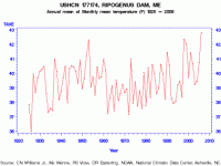
See larger graph here.
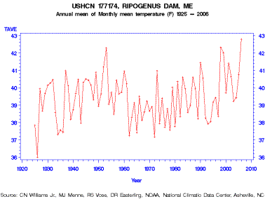
So how is that? The station closed in 1995 but the data continues until 2006? Did some of the world’s leading climate scientists create the data from thin air? Well, not exactly. Part of the USHCN data is created by a computer program called “filnet” which estimates missing values. According to the NOAA, filnet works by using a weighted average of values from neighboring stations. Filnet is applied after a homogeneity adjustment which is not designed to find many of these problems. Imagine that, the worlds leading climate scientists creating temperature data from surrounding stations which are biased by barbecues, bodies of water, wind blocks, jet engines, pavement, roof tops, air conditioner exhausts, inversion layers, non-standard equipment, urban heat islands, automobiles and chimneys.
They didn’t create climate data from thin air; they created it from junk. Again see this full post.