


By Joseph D’Aleo
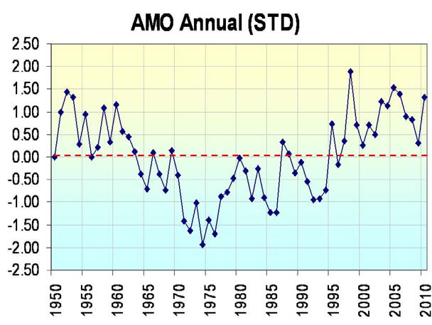
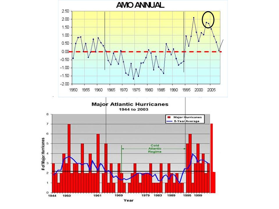
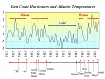
Both Drs. Gray and Klotzbach and NOAA and many in private industry are predicting a very active Atlantic tropical season. Since 1995, the Atlantic has become twice as active on average as the prior 25 years, similar to the period from 1930s to 1960s. This is due to a shift to the “warm” mode of the multi-decadal scale oscillation in the Atlantic Ocean.
Most of the storms making landfall since 1995 have impacted the Mid-Atlantic region, Florida and the Gulf of Mexico However, though not yet realized, history tells us that the risk has also increased for more populated areas to the north (Long Island and New England) (below, enlarged here and here).

Note the increase in the number of stronger storms after the flip back to the warm mode in 1995 (below, enlarged here and here).
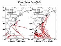
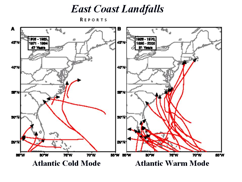
Bill Gray has shown the number of land falling storms along the southeast coast increases in the warm mode (above). The same can be said for the Atlantic coast in general as shown below (enlarged here).
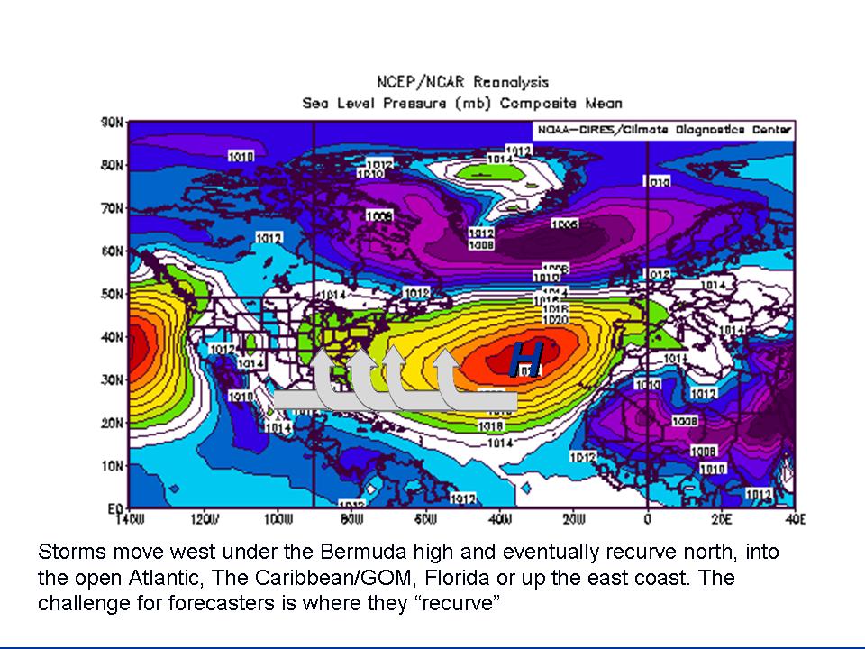
Those that survive often recurve out to sea or escape the shear by taking a more southern route through the Caribbean to the Gulf, where most make landfall.
The landfall depends on the strength and position of the Bermuda High in the Atlantic. A tropical system will tend to turn north at first opportunity including a weakness in the Bermuda high. The stronger and farther west the high extends, the further west the storm moves before turning or landfall (enlarged here).
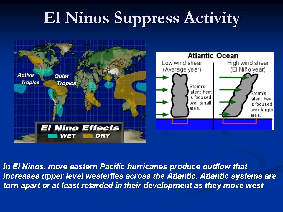
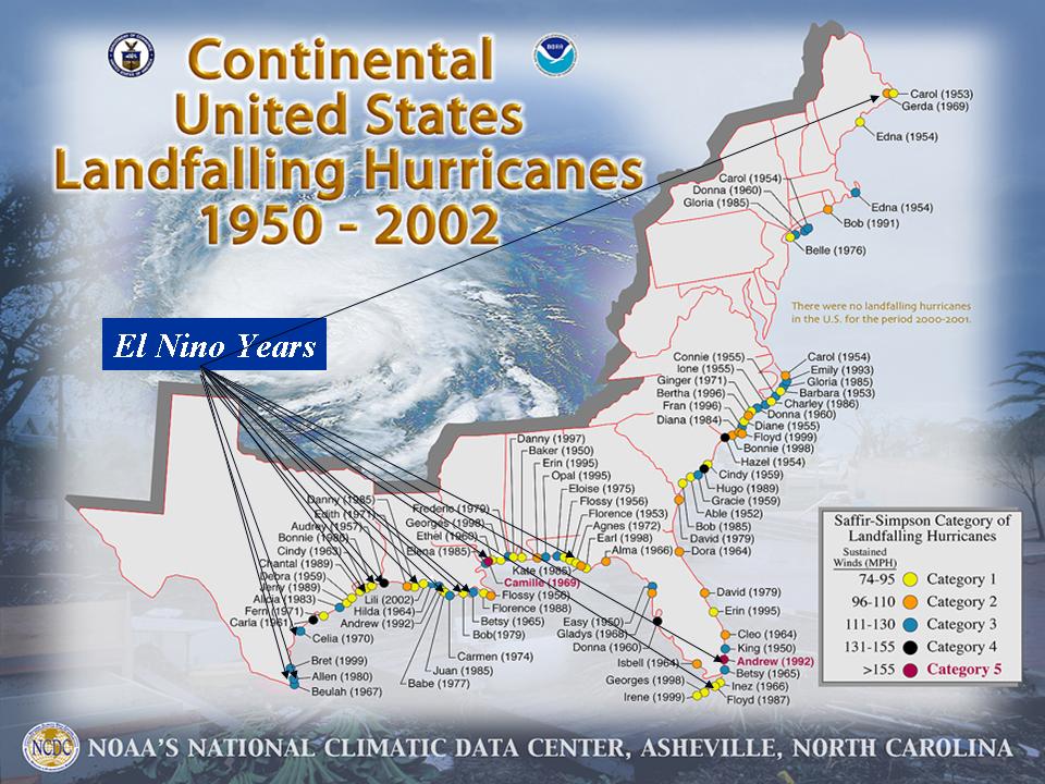
El Ninos tend to produce fewer storms by increasing the shear in the Atlantic, fed by increased Pacific tropical activity (enlarged here).

Those that survive often recurve out to sea or escape the shear by taking a more southern route through the Caribbean to the Gulf, where most make landfall (enlarged here).
La Ninas on the other hand show less shear, more storms and more landfalls. Weakness of pressure along the east coast favors more landfalls(enlarged here).
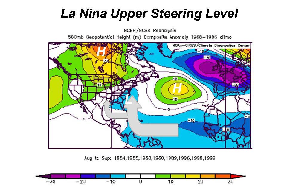

Those that survive often recurve out to sea or escape the shear by taking a more southern route through the Caribbean to the Gulf, where most make landfall (enlarged here).
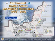
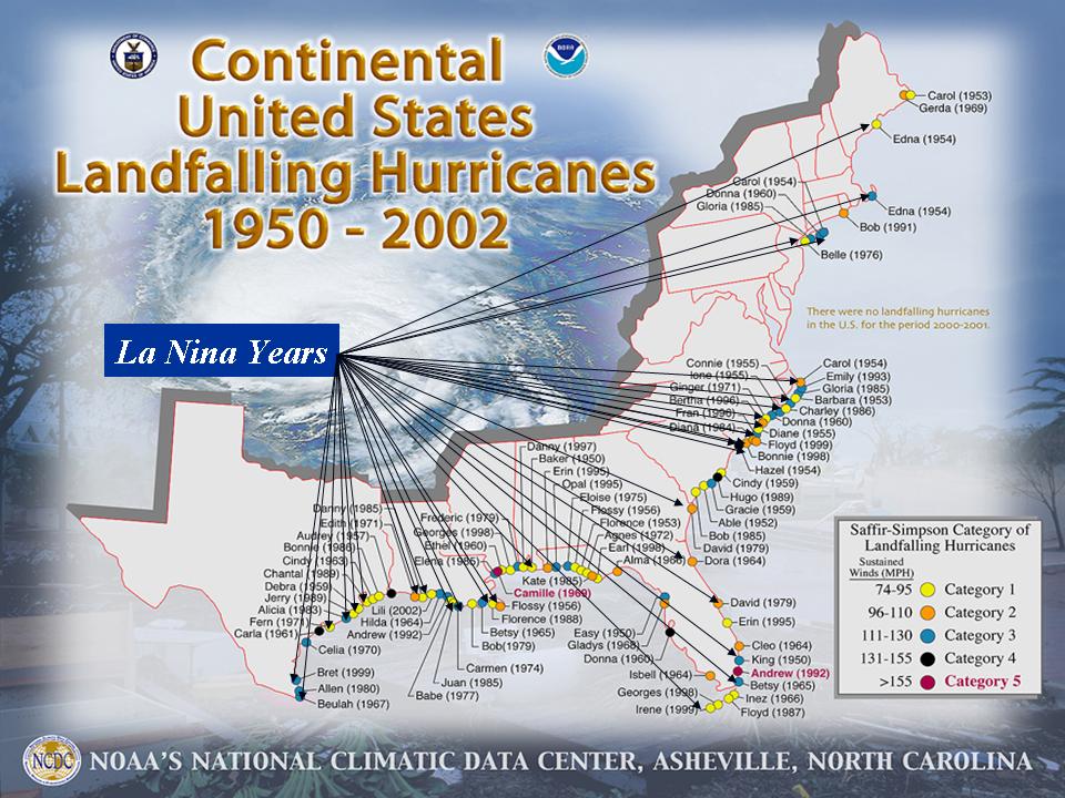
The La Nina landfalls are in the Gulf, Southeast Coast and the Northeast/New England.
THE EFFECT OF THE PACIFIC DECADAL OSCILLATION
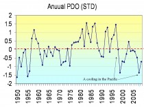
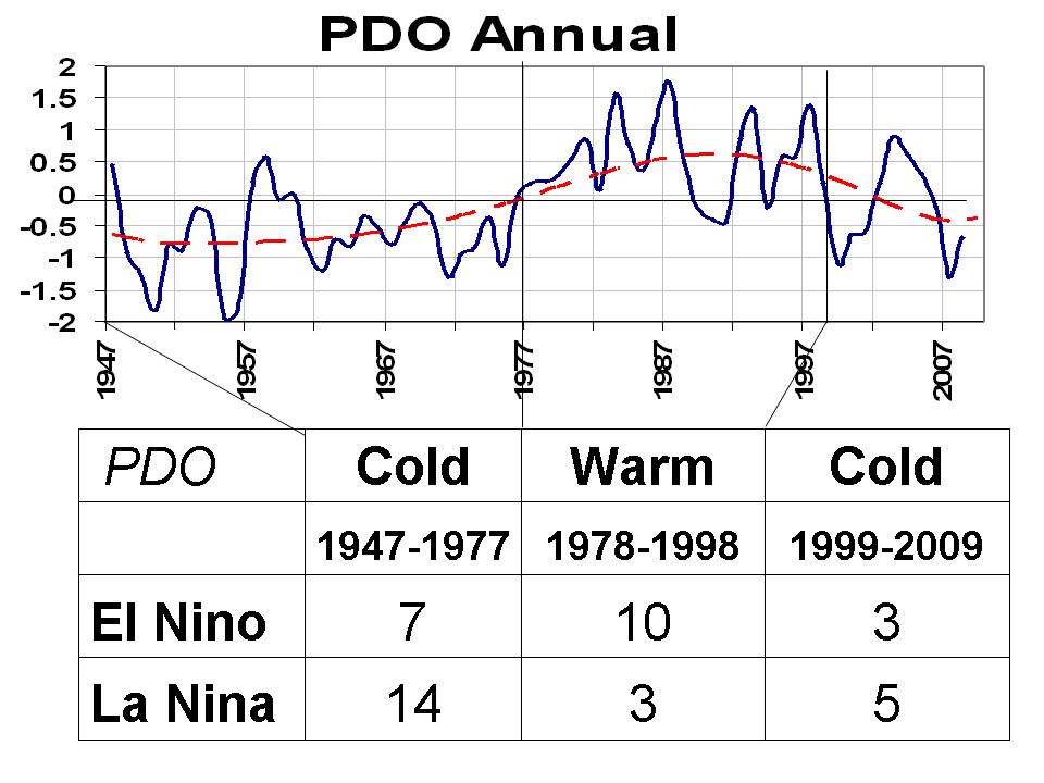
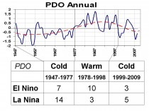
The PDO affects the relative frequency of the El Nino and La Nina. We turned to the colder mode of the PDO in the late 1990s, which tends to mean more La Ninas like the last cold mode 1947 to 1977(enlarged here).
The area of the east coast north of Cape Hatteras risk is greatest during La Nina years when the PDO is negative and the Atlantic is warm (this summer!) (enlarged here).
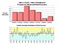
See how New England landfalls vary with the PDO (enlarged here).
La Nina Years Occurring with Warm Atlantic Summers
* 1938 Hurricane of ‘38 (CAT 5) New York and New England
* 1950 Hurricane Easy (CAT 3) Florida, Hurricane King (CAT 3) Florida
* 1954 Hurricane Carol (CAT 3) New York and New England, Hurricane Edna (CAT 3) New England, Hurricane Hazel (CAT 4) Mid-Atlantic and northeast
* 1955 Hurricane Connie (CAT 3) NC, VA, NY, New England Flooding, Hurricane Diane (Cat 1) NC, New England Flooding
* 1960 Hurricane Donna (CAT 4) FL, (CAT 3) NY, New England
* 1989 Hurricane Hugo (CAT 4) SC
* 1996 Hurricane Bertha (CAT 2) NC, Hurricane Fran (CAT 3) NC
* 1998 Hurricane Bonnie (CAT 2) NC
* 1999 Hurricane Floyd (CAT 2/3) NC
15 landfalling storms in the 9 years!!!!! 11 major hurricanes. 9 affected northeast
HOW THE TROPICAL ATLANTIC WARMED
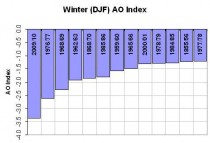
Ironically this was the result of the record negative AO and very cold Northern Hemisphere winter in the southern US, Europe, Russia, China. A record negative AO suppressed jet streams and subtropical highs in both oceans (enlarged here).
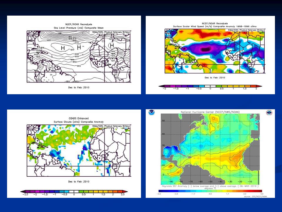
Lower wind speeds and reduced cloudiness due to subsidence in the deep subtropics led to warm water near the surface (bottom right) (enlarged here).
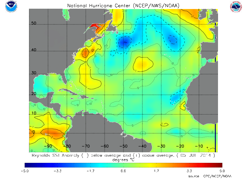
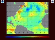
The very latest Atlantic sea surface temperature analysis from the Hurricane Center showing the warm water that will help feed the activity (enlarged here).
All this raises great concern about landfalling hurricane and the threat of one or more systems affecting the northeast that since 1995 has seen only remnants of storms that made landfall south. See the fill PDF with enlarged graphics here.
Also the first tropical storm of the season from the eastern Pacific hit Central America this weekend with deadly results.