By Jim Irwin, AP
A fast-moving New Year’s Day storm dumped more than a foot of snow on southeastern Michigan, a record blast that made driving hazardous, snarled the flight home for holiday travelers. The storm left 10 to 16 inches of snow across parts of Oakland, Lapeer and St. Clair counties north of Detroit, the National Weather Service said. The western St. Clair County community of Capac reported 16 inches.
“This storm most definitely packed quite a wallop,” said Weather Service meteorologist David Shuler in Oakland County. “This will be a memorable storm for the amount of snow it dumped in such a short amount of time.” He said it was the region’s heaviest New Year’s Day snowstorm on record and was unusual for its intensity. In the heart of the storm, snow fell at a rate of at least 2 inches an hour, with periods of 4 inches an hour. Thousands of people in Michigan and Ohio lost power.
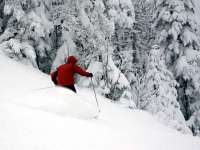
That followed a storm in the Northeast on Monday that made it the snowiest December in the region in decades. December’s snowfall at Concord, N.H., totaled 44.5 inches, toppling a record of 43 inches that had stood since 1876. Burlington, Vt., got 45.7 inches, far above its 17.2-inch December average, and Portland, Maine, amassed 37.7 inches for its third-snowiest December on record. New Hampshire has already spent $30 million on snow removal out of the $75 million budgeted for the entire winter, said highway department spokesman Bill Boynton. However, New England ski resorts enjoyed the flurry of storms after last year’s lack of snow early in the season. In Maine, it provided a fresh layer on top of the roughly 6 feet that the state’s two biggest ski resorts, Sugarloaf USA and Sunday River, each got last month. “It’s been unbelievable,” Sugarloaf spokesman Bill Swain said. “It just keeps coming.”
Read more here.

Icecap Note: Very cold weather (all the way south to Florida) the next few days will give to moderation and in places in the north the best winter sports in a long time this weekend. Next week the warming will be significant through at least midweek. Cold weather will return in stages starting late next week. More on the weeks ahead later this week.


