


By Joseph D’Aleo
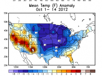
Over 3000 record lows or record low highs have occurred in the last month and over early 100 snow records for the US. A major early cold outbreak looks to be in the cards for end of the month and early November.
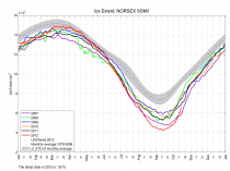
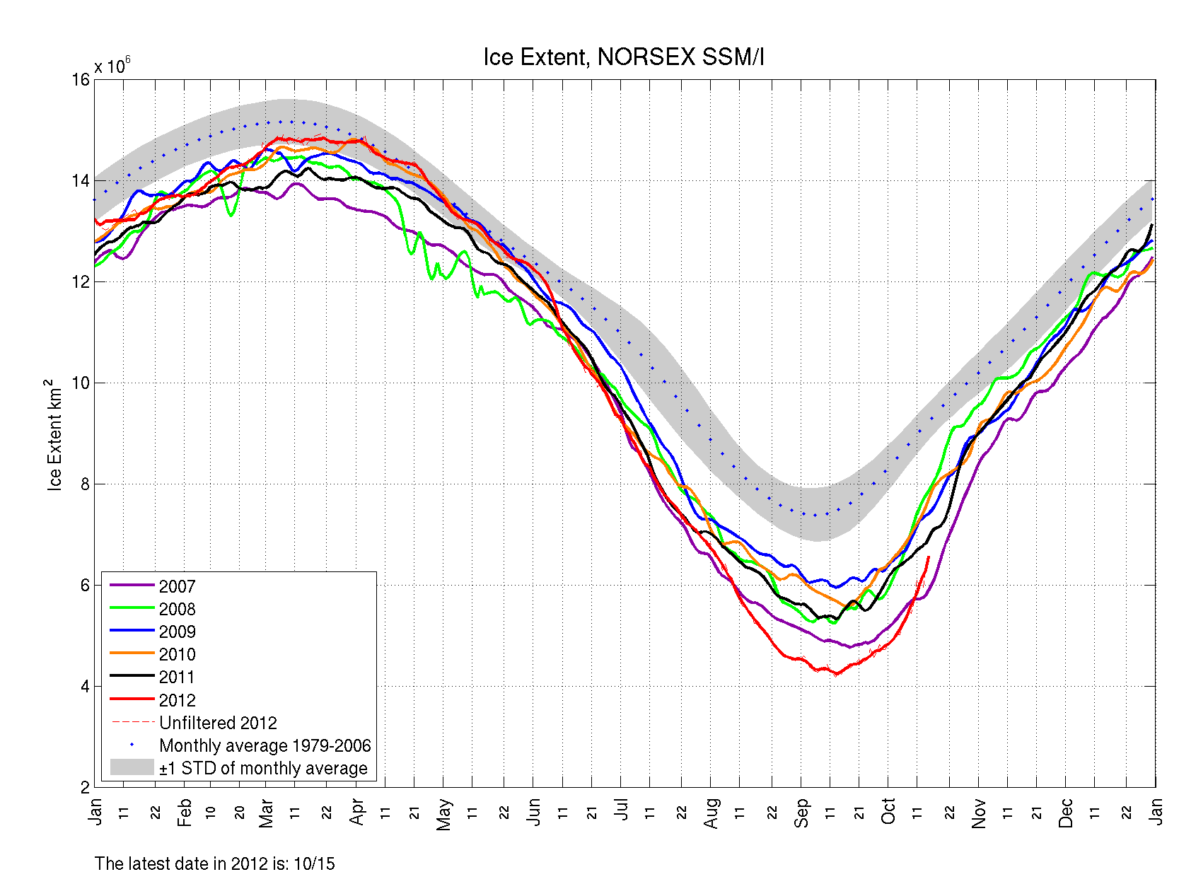
Ice meanwhile which rapidly diminished when a major early August storm compacted the ice is rapidly recovering.
Enlarged
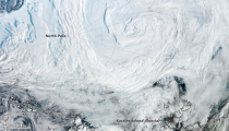
As NASA reported:
An unusually strong storm formed off the coast of Alaska on August 5 and tracked into the center of the Arctic Ocean, where it slowly dissipated over the next several days.
The Moderate Resolution Imaging Spectroradiometer (MODIS) on NASA’s Aqua satellite captured this natural-color mosaic image on Aug. 6, 2012. The center of the storm at that date was located in the middle of the Arctic Ocean.
The storm had an unusually low central pressure area. Paul A. Newman, chief scientist for Atmospheric Sciences at NASA’s Goddard Space Flight Center in Greenbelt, Md., estimates that there have only been about eight storms of similar strength during the month of August in the last 34 years of satellite records. “It’s an uncommon event, especially because it’s occurring in the summer. Polar lows are more usual in the winter,” Newman said.
Arctic storms such as this one can have a large impact on the sea ice, causing it to melt rapidly through many mechanisms, such as tearing off large swaths of ice and pushing them to warmer sites, churning the ice and making it slushier, or lifting warmer waters from the depths of the Arctic Ocean.
“It seems that this storm has detached a large chunk of ice from the main sea ice pack. This could lead to a more serious decay of the summertime ice cover than would have been the case otherwise, even perhaps leading to a new Arctic sea ice minimum,” said Claire Parkinson, a climate scientist with NASA Goddard. “Decades ago, a storm of the same magnitude would have been less likely to have as large an impact on the sea ice, because at that time the ice cover was thicker and more expansive.”
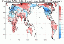
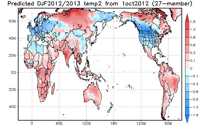
Here is what the JAMSTEC climate model suggest for this winter
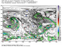
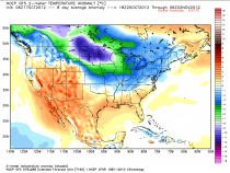
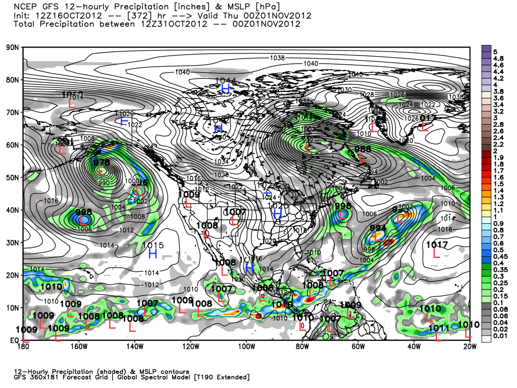
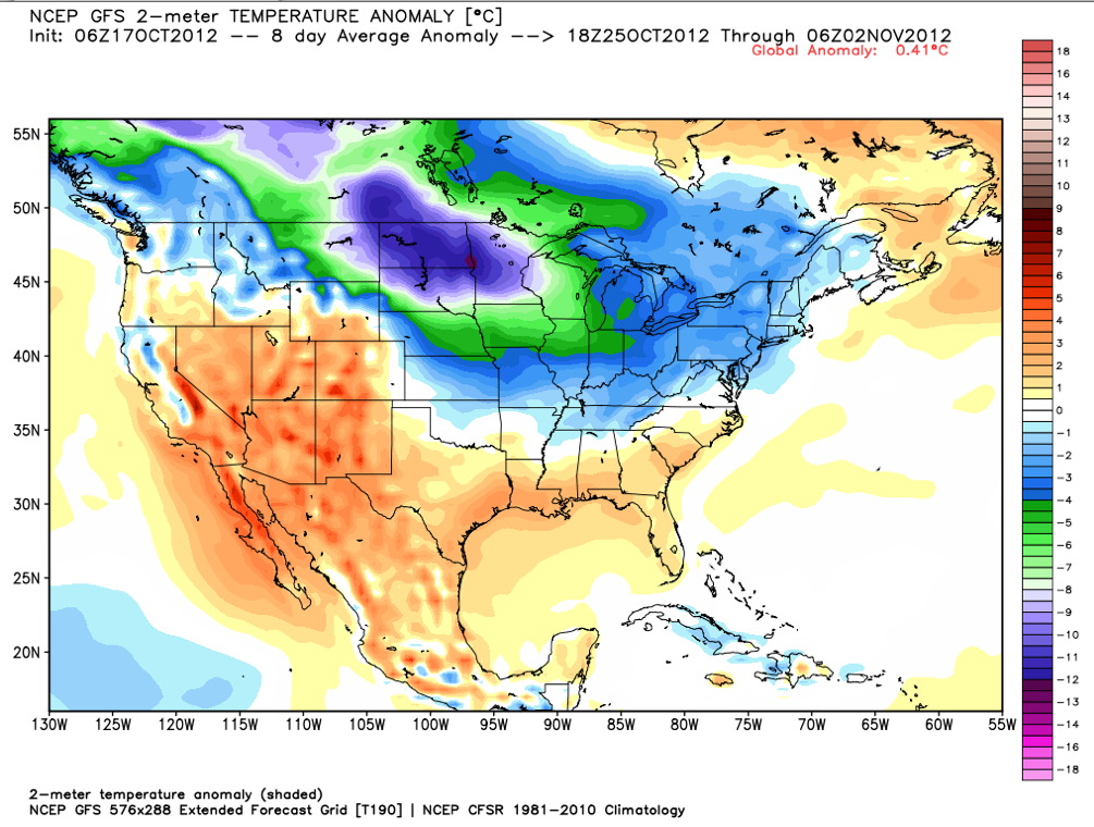
Over at Weatherbell.com, Joe Bastardi and I have been blogging and doing videos on the winter and the factors involved for the US and globe. You get two cups of “Joe” for half or less the cost of one cup of coffee a day. And you get the mastery of Dr Ryan Maue with a model model page that grows daily. It alone is worth the price of admission. Here is a GFS forecast with a monstrous menacing cold high at the end of the month and the 5 day mean showing the cold extending south..