


By Dr. Vincent Gray, NZ Climate Truth Newsletter
We are daily told that Paific Islands are “threatened” with rising sea levels. Yet many estasblished measurements, for example in Tuvalu, do not agree.
In 1990 the Australian Government became so worried about the obstinacy of the measurements that they launched The South Pacific Sea Level and Climate Monitoring Project (SPSLCMP0. This has placed the most sophisticated equipment ever developed (SEAFRAME) on 12 Pacific Islands Cook Islands, Federated States of Micronesia (only from 2003), Fiji, Kiribati, Marshall Islands, Nauru, Papua New Guinea, Samoa, Solomon Islands, Tonga, Tuvalu, and Vanuatu. The results are so startling that they have never been published in “peer reviewed” Journals and are only available on the websites . The main one is here although they try to rediredct you to the following site which provides the message “This page cannot be found”
A summary of the results was preesented by Philip Hall in 2006 here. However, this does not provide any of the actual records. It provides alleged “trends”, which are misleading.
The actual records can be found here. There are 12 seperate Reports, one for each island. They all contain the same initial section, which is concentrated in claiming that there are upward “trends” in sea level in every island. Only at the end do you get the a record of actual measurements by the SEAFRAME equipment, but only for that particular island. If you want to see all the records and compare them you have to download the twelve seperate Reports. .
My Report “South Pacific Sea Level: a Reassessment” here is the only paper which collects all of the actual measurements of sea level on all twelve islands.
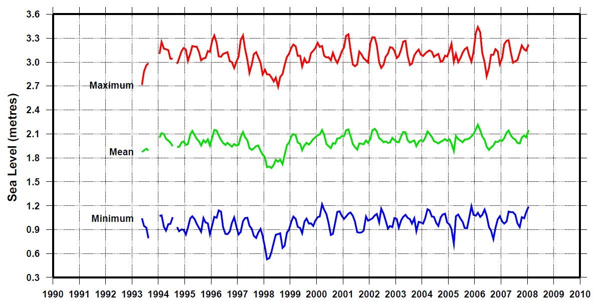
The records all show a degree of irregularity. The seasonal change is present in all. The main irregularity is associated with the Tropical Cyclones and Tsunamis that affected all the islands at some time during the SEAFRAME measurements, which are usually since 1991. The dates of the cyclones and tsunamis for that particular island are given in each Report. The 1998 El Niño cyclones are present on nearly all of them. They caused a depression in sea level which may be an artefact, due to disturbance of the region close to the instruments. They also seem to cause a slight jump in the measurementl which could be due to a disturbance in the level of the instrument. With Fiji, Nauru, Samoa, Solomons, Tonga, the measurement jumped slight;y upwards after the hurricane It seems very likely that the hurricane disturbed the equipment. In the year 2000 all of the instruments were equipped with an up-todate Global Positioning system, so the measurements after that date are the most reliable.
The anonymous scientists involved showed there were upwards “trends” based entirely on a linear regression on the whole series, including the first one or two figures, which could be influenced by teething troubles, and the disturbances caused by cyclones and tsunamis, They failed to notice that after the Global Poitioning equipment was installed in the year 2000 eleven of the twelve islands showed no change in sea level. Kiribati and Nauru showed no change since 1993, Cooks, Marshalls and Tuvalu since 1994, Papue New Guinea and Vanuatu since 1995. The Fedrated Stes of Micrnesia, starting in 2002, showed no change after 2003.
I conclude that the South Pacific Sea Level and Climate Monitoring Project has provided unequivocal evidence that sea level is not rising near any of the Pacific islands, and that they are not “threatened” in the way claimed.
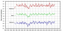
It will be interesting to see what happens to the measurements as a result of the recent tsunamis. I would be glad to send my paper to anybody interested, but I thought I could hardly send all twelve records here. I have attached Tuvalu, which is persistently claimed to be sinking.
The question arises, is it typical? I think it quite likely that the phenomena shown here, of disturbance to equipment when subjected to hurricanes or severe weather, may be responsible for many of the records showing sudden upward jumps. The records are also subject to neighbouring land subsidence due to weight of buildins and removal of ground water and minerals. .
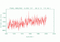
Many records begin to level off as soon as they install GPS; for example, Auckland (below)
The Topex/Poseidon/Jason satelite series shows a riise of sea level since 1993 but it has levelled out since 2006 , It might be subject to ocean oscillations more than sites adjacent to the land, which after all, are what matters to people who live there.