


By Joseph D’Aleo, CCM, AMS Fellow
A look back on Irma and Harvey :
Update: irma will make landfall in south Florida Sunday as a major hurricane. Models which had teased a track along the eastern parts of the state are talking aim at the keys and then the entire peninsula.
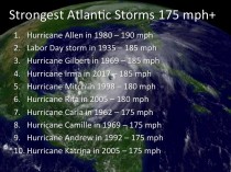
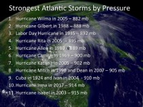
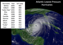
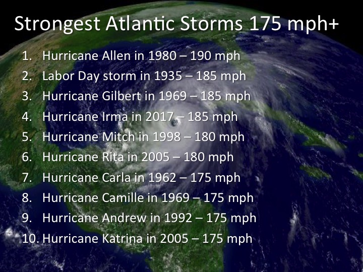
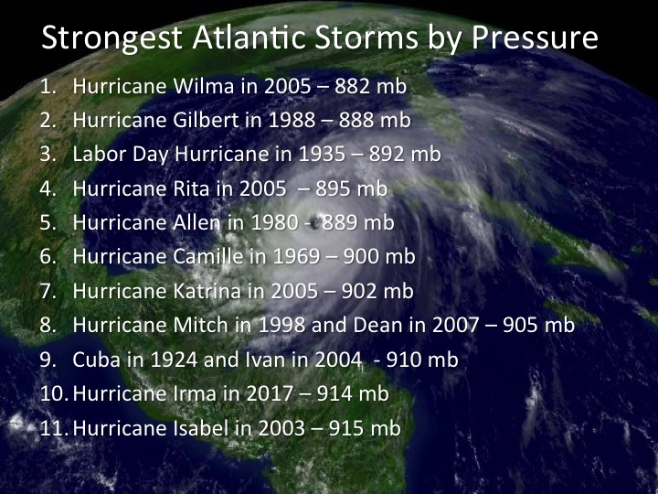
In its devastating journey through the northern Leeward Islands, Virgin Islands as a CAT 5 storm with winds estimated at 185mph, it ranked second for wind and 10 for lowest pressures.
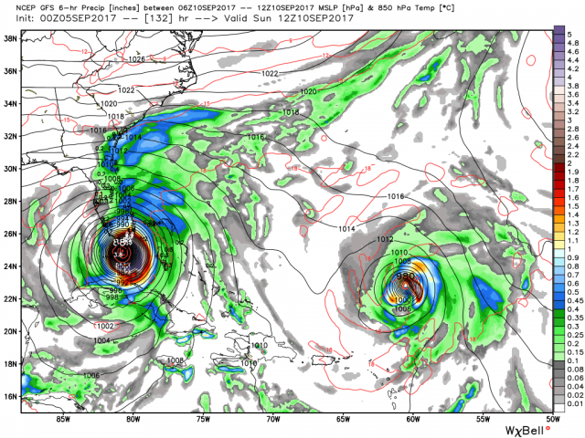
It has weakened to a CAT 4 with winds of 155mph and central pressure of 925mb. After moving along the Cuba coast, it will turn north and likely intensify again.
Join us on Weatherbell.com to see all the details in posts and videos.
-------------------------
The name Irma is derived from the German ‘Ermen’ which mean ‘whole’. You can drop the ‘w’, in terms of pressure it has become a literal ‘hole’ in the atmosphere. Irma has intensified to a powerful very dangerous CAT5 hurricane with a central pressure of 929mb and winds of 175mph.
Here is the latest water vapor image.
_thumb.gif)
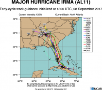
Here is the projected 5 day tracking skirting the islands on its way west.
_thumb.png)
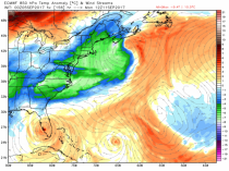
It is forced west by a strong high pressure in the Atlantic, ‘king ridge’ as my meteorological buddy Al Lipson calls it. It won’t make its turn north (something all tropical storms look to do at first opportunity) until the ridge weakens or the storm reaches the western end of the ridge. This is the first and often the biggest challenge in hurricane forecasting.
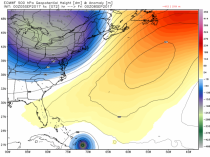
See also the cold trough to the north in the Great Lakes into the northeast. See how that cold trough north moves out into the Atlantic and the ridge collapses this weekend.

See how in the lower levels the trough to the north is a cold one, the low above Irma is warm core. At 18,000 feet it is colder than -20C in the northern trough but more than +3C over Irma. Above freezing temperatures at 18,000 are confined to the strongest heat waves and the stronger hurricanes.
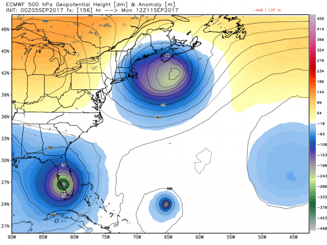
See the US GFS model take Irma into Florida with pressures in the 880s mb. The strongest Atlantic Basin storm was Wilma in 2005 with 882mb central pressure in the Gulf. It weakened a bit to CAT3 when it slammed Florida.
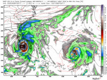
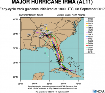
See the ensemble members of the GFS mainly target Florida. It should be noted some models and ensemble members of the other models turn north before Florida and others take the storm west of Florida before turning north.
Did you ever miss an exit on the highway or the street you wanted to turn on. You have to go to the next exit or street that is one way the right way. Do you remember Katrina which was rolling southwestward and faster than the models which had it turning just west of the Florida towards Apalachicola. It went out into the central Gulf before turning and the rest was history.
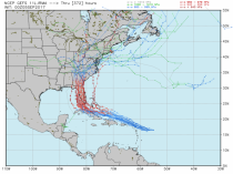
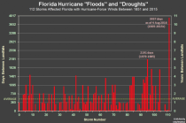
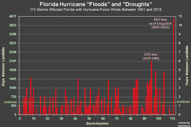
Just like Harvey ended the record major hurricane nearly 12 year drought for the U.S., it it makes landfall in Florida it will end the record hurricane drought also since Wilma in 2005.
.png )
Please take this storm very seriously and consider your options and follow local emergency management directives. Join us at Weatherbell.com where our team is doing frequent updates and videos.