


By Joseph D’Aleo, CCM
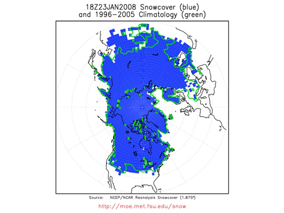
With a major snowstorm in China and snow covering much of Asia and parts of the middle east and a decent snowpack in North America (recently NASA reported 60% of the lower 48 states and all of Canada was snowcovered), our Northern Hemispheric snowcover is now 2% above normal and the highest level in at least 5 years. A rather amazing 25% of the northern Hemispheric is snow and ice covered. The next two images come from Dr. Bob Hart at Florida State University. In the first, the green line represents the normal snowcover extent for the date and the blue the actual snowcover.

See full size image here.
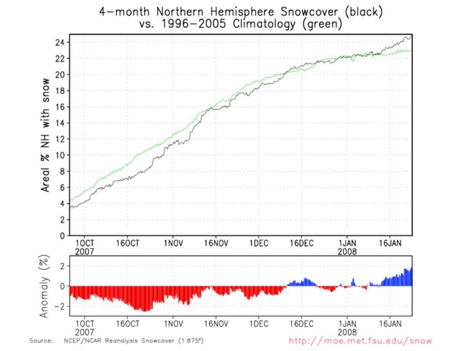
In the second image the actual percent (black) is plotted relative to the climatological (green). We reversed a 2% snow and ice coverage deficit this past summer and now have a 2% excess (above normal).

See full size image here.
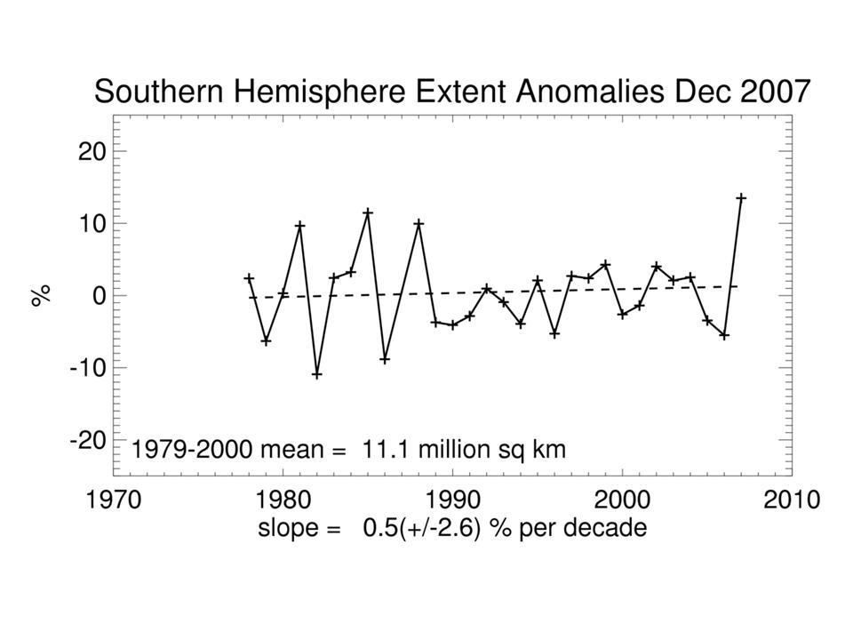
December sea ice extent in the Southern Hemisphere was a remarkable 15% above normal and the highest of the entire record as was the case in the late winter (it is now mid-summer and the sea ice is diminishing but is still well above normal). This graph is from the University of Illinois National snow and Ice data Center and shows the satellite derived sea ice extent in the southern hemisphere for Decembers since records began in 1979.

See full size image here.