


By Joseph D’Aleo, CCM
It has been quite an incredible January. It started with several days of frigid temperatures with freezing temperatures and record cold even down to Fort Myers, Florida. Then a major storm in the west and several even more amazing warm days with over 200 record highs. The warmth began to ease this week with a series of fronts that brought tornadoes to the central states as far north as Wisconsin and rare January thunderstorms to the northeast today. Temperatures will continue to ease down slowly so that by Sunday night and Monday the next storm will be bringing a heavy wet snow to the northeast.
More seasonable January cold will follow well into next week before another storm moves up the coast bringing more precipitation including ice and snow. Real deal arctic air follows that system and dominates the following week. But the storms will keep coming bringing heavy amounts to areas that got it in December and many areas that were left out then. In the last days of the month, with the Pacific blocked off by a large eastern Pacific ridge, bitter arctic air will stay in control and dominate across the north. How deep into the south the arctic air pushes depends on whether blocking develops in the North Atlantic as some of the ensemble models have suggested. In any event, the rest of the month looks to be memorable for many parts of the nation.
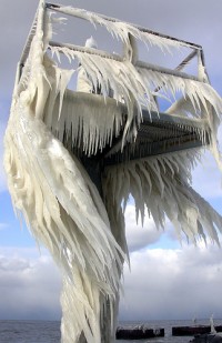
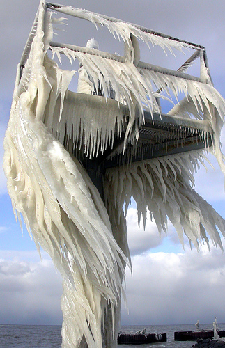
See full size image here. Interesting picture of ice texture on a watch tower located on a pier at the south side of Lake Erie in the US. Arctic winds from Canada blew water from wave crests along the lake, and the water froze as it hit the tower. Picture courtesy of Brian Valentine