


By Joseph D’Aleo, CCM
For Madison, Wisconsin, if the forecasts for the last three days of the month turn out close to accurate, January will average just about exactly normal. Someone years from now looking back at the month might assume it was a boring month. The folks who live there, where I spent 6 wonderful years at the University, will tell you it was anything but.
Take a look at the daily highs and lows for the month. The last three days are utilizing the local forecast office forecast values. After a frigid start, a ten day warm spell set in which peaked in week 2, held back by the snowpack that had built up from the second snowiest December on record and never entirely disappeared even during the warm days. Cold set back in on the 14th and really deepened after the 17th until the 25th. Moderation followed with today the 28th being the warmest day but it will be brief with another day blast of arctic air hitting hard late tomorrow into Wednesday when below zero readings return. 11 days of the month will have had below zero (F) readings, one day for an entire 24 hours. In contrast four days stayed entirely above freezing.
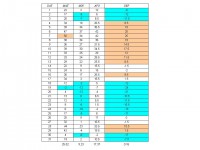
See full size table here
The city had 20.6 inches of snow as of this morning for the month following the second snowiest December which had 33.5 inches. The seasonal total with the 1.5 inches on November is 55.6 inches with two plus months more to go in the snow season. Normal total seasonal snow there is 44.1 inches, so already they have had a foot more than the normal amount of snow.
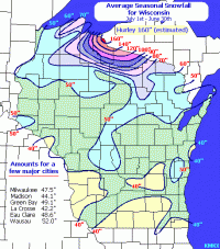
See full size map here
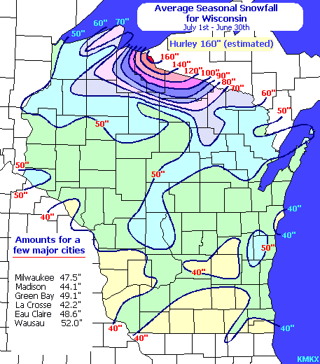
This confirms (1) how fickle and extreme La Ninas can be and (2) how they often produce above normal snows across the north central states. See pdf of this here.