


On January 6, we wrote
“After a couple more cold days, moderation will take place but note that winter when the cold does this, it often repeats and models indicate it may after 10 days, probably extending a little further east. Join us at weatherbell.com and read about the threat. We correctly forecast this cold winter and this outbreak many days in advance.”
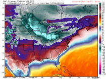
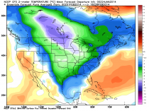
Well for the last several week we have been telling subscribers commercial clients for over the last two plus week that that cold reprise was coming. That cold has started and unlike the early month cold will keep on coming in waves with the cold early next week probably COLDER than that with the now famous ‘polar vortex’. Here is the forecast anomaly for the next 8 days:
_thumb.png)
Temperatures are forecast by the model 30F below normal and well below zero into the midwest shattering long term records. I would not be surprised to see lows of 40 to 50F below zero in Minnesota and 20 to 30 below in the Ohio Valley where the coldest air is forecast to settle. That is not wind chill but actual temperatures.
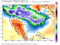
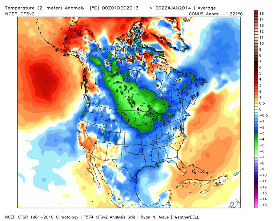
The cold doesn’t end then though the core may shift west and northwest again while it reloads. The following period may be characterized by big storms. The next week will feature fast moving ‘clipper’ storms the bring in fresh cold. The southern storm track may be activated by changes in the tropical Pacific. with the potential for a snowstorm between the 3rd and 6th of February. Here are the week 2 anomalies - still well below normal. Chicago, Philadelphia and NYC have already exceeded there normal seasonal snowfall and more is coming.
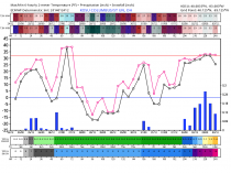
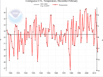
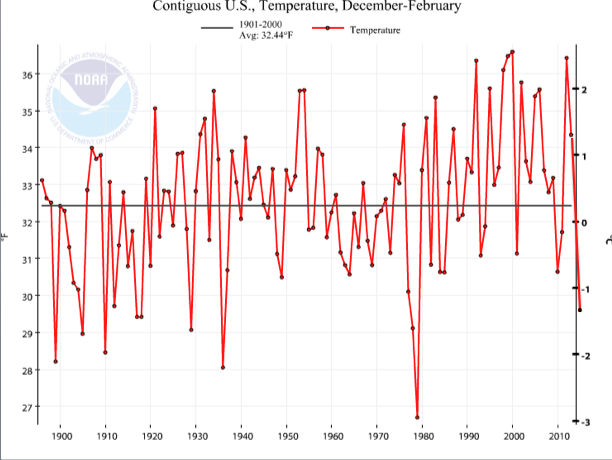
This is the anomaly so far this season.
Note it is 1.22C below normal for the lower 48 states. If that persists through February (and the models are cold for February, the winter would rank with the cold winters of the late 1970s. I have aded that to the NCDC graph of winter CONUS temperature anomalies. Of course NOAA has its magic adjustments it makes to the actual data so we will see. This analysis is based on actual observations that go in to the forecast models 4 times daily.
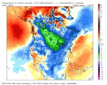
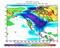
Here is the CFS model February forecast,
At Weatherbell, we saw this winter coming months ago. Here is a forecast issued in the fall to clients in our ag service. It is based on our own proprietary multivariate statistical model approaches. We have expanded inputs into the approach and have been hitting it out of the park this past year.
.png)
Joe Bastardi had a similar forecast for the energy clients and last week when one operational 16 day forecast model run suggested the cold broke, JB told our clients NO and indeed the market has soared when all the models came back to a cold solution. The energy market sold off but then went into panic buying mode. Our client made money.
Please join us at Weatherbell and you will get our insights and forecast, videos and Dr. Ryan Maue’s superior model graphics and value added products. JB and I have been posting and forecasting for the markets daily since March 2011 at Weatherbell. Not only can you find superior temperature forecasts, but we have hit every major snowstorm, hurricane and tornado outbreak event many days in advance. If you have a weather sensitive business, you cant afford to rely on the unreliable model based point and click on the internet nor the model hugging forecast services. You need dependable guidance and hand holding. (Weatherbell.com)
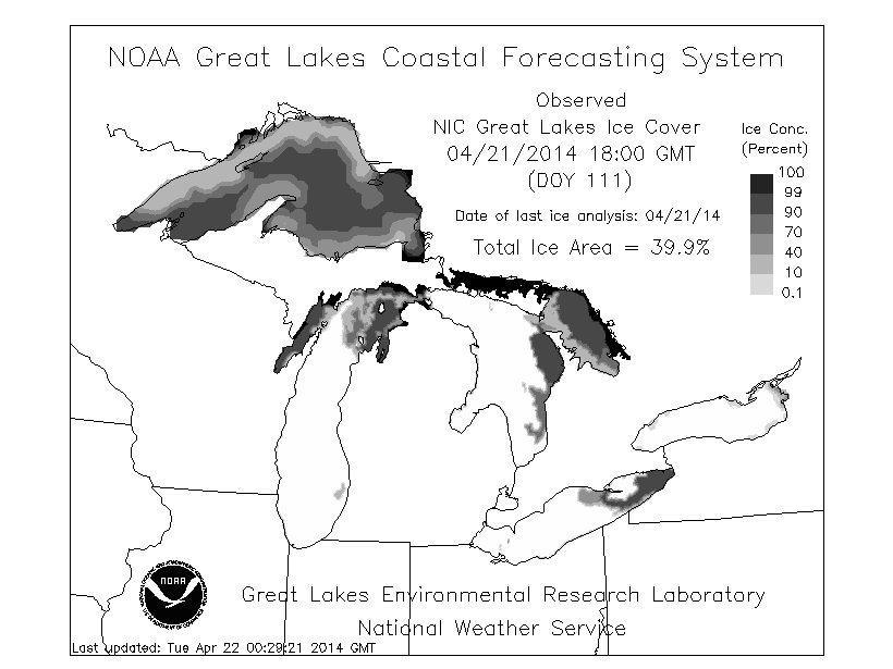
By the way, the impact of this coming cold will be far reaching. the Great Lakes ice will increase to levels of 1993/94 or greater. Great Lakes barge traffic and barge traffic on our major rivers will be stopped by ice. Look for the Potomac, Hudson, parts of New York Harbor to freeze. The chart below shows the ice coverage in % (black is 100% coverage, white open water, greys partial ice).
Enlarged